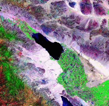
Salton Sea
Quick Links: ABOUT THE SALTON SEA | SALTON SEA WATERSHED | REGIONAL WATER BOARD SALTON SEA ACTIVITIES | RESOURCES | CONTACT INFORMATION | EMAIL LIST
About The Salton Sea
Salton Sea is California's largest inland lake, situated at 233 feet below sea level. The sea measures about 35 miles in length, with a maximum width of about 15 miles. The total surface area of the sea covers approximately 343 square miles with a 95-mile long shoreline. Inflows to the Sea are composed predominantly of agricultural drainage flowing from Coachella and Imperial Valleys. As the California drought persists, these flows will continue to diminish and cause the Salton Sea to shrink, increasing in salinity at an accelerating rate. The salinity of Salton Sea has increased from 35 parts-per-thousand in 1974 to 57 parts-per-thousand in 2015. In comparison, salinity of the Pacific Ocean ranges between 32 to 37 parts-per-thousand. Apart from the rising salinity, one of the most growing concerns is the bioaccumulation of contaminants, mainly pesticides and selenium.
Salton Sea was once famous for its sport fishery that has since declined, along with its recreational uses. The Sonny Bono National Wildlife Refuge is located along the Pacific Flyway, serving as a stopover for migrating birds, including several state and federal listed endangered and threatened species. The Refuge was established as a waste sump for agricultural drainage in 1928, and in 1930, a portion of the south end was designated as a wildlife refuge to preserve wintering habitat for waterfowl and other migratory birds. Mass die-offs of birds and fish have occurred in past years, raising concern for the future of these beneficial uses.
Salton Sea Watershed
The Salton Sea Transboundary Watershed (USGS Hydrologic Unit 18100200) is the Priority Watershed in the Colorado River Basin Region. It encompasses one-third of the region (about 8,360 square miles) and contains five (out of a total of six) of the Region's impaired surface waterbodies. Most of the watershed is in Imperial County. The watershed has been identified as a Category I (impaired) Watershed under the 1997 California Unified Watershed Assessment (UWA). The California UWA was developed and implemented in response to the Clean Water Action Plan released by President William Clinton and Vice-President Albert Gore on February 19, 1998. The UWA was a collaborative process between the State and the United States Environmental Protection Agency (USEPA) and was developed to guide allocation of new federal resources for watershed protection.
See the Salton Sea Transboundary Watershed Staff Report
Major waterbodies in the watershed include the Salton Sea, the New River, the Alamo River, and the Imperial Valley Agricultural Drains and the Coachella Valley Stormwater Channel.
New River
The New River originates in Mexico. It flows approximately 20 miles through the City of Mexicali, Mexico, crosses the International Boundary, continues through the City of Calexico in the United States, and travels northward about 60 miles until it empties into the Salton Sea. Its flow at the International Boundary is about 150 to 200 cubic feet per second (cfs). (108,400 to 145,000 acre-feet per year (AFY)). The New River carries urban runoff, untreated and partially treated municipal wastes, untreated and partially treated industrial wastes, and agricultural runoff from the Mexicali Valley, Mexico across the International Boundary into the United States. In addition, the River carries urban runoff, agricultural runoff, treated industrial wastes, and treated, disinfected and non-disinfected domestic wastes from the Imperial Valley. It also carries approximately 6 to 11 cfs (4,350 to 7,970 AFY) of treated wastewater from point sources in Imperial Valley. The New River flow at the Salton Sea is about 600 cfs (430,000 AFY).
Alamo River
The Alamo River originates approximately two miles south of the International Boundary with Mexico, and flows northward across the border for about 50 miles until it empties into the Salton Sea. The Alamo River is dominated by agricultural return flows from Imperial Valley. It also carries approximately 15 to 27 cfs (10,867 to 19,200 AFY) of treated wastewater from point sources in Imperial Valley. Its flow at the International Boundary is three to five cfs (2100 to 3620 AFY), whereas at its delta with the Salton Sea is about 800 to 1000 cfs (600,000 to 800,000 AFY).
Imperial Valley Agricultural Drains
The Ag Drain system comprises over 1,450 miles of surface drains, which discharge into the Alamo and New Rivers and the Salton Sea [2.11]. The Ag Drains primarily carry agricultural runoff from the Imperial Valley. Agricultural discharges in the Imperial Valley average about 830,000 acre-feet/year. Of this amount, approximately 36 percent is tailwater, 33 percent is seepage, and 30 percent is tilewater. The resulting mix of tailwater, tilewater, and seepage contains pesticides, nutrients, selenium, and silt in amounts that violate water quality standards.
Coachella Valley Stormwater Channel
The Coachella Valley Stormwater Channel flows southward though the Coachella Valley and discharges to the Salton Sea. The Coachella Valley Stormwater Channel flows include stormwater, agricultural discharges, and treated municipal and aquaculture wastewater.
Regional Water Board Salton Sea Activities
Water Quality Control activities addressing Salton Sea Watershed impairments span across multiple programs of the Regional Water Board. These programs include the Total Maximum Daily Load, the Surface Water Ambient Monitoring Program, the Irrigated Lands Regulatory Program, the New River Pollution, the Salton Sea Management Program and Other Programs.
Total Maximum Daily Load (TMDL) Program
Regional Water Board Staff continue to develop and implement TMDLs to address impairments of the Salton Sea and its tributaries.
- Regional Water Board TMDL Program Page
- Imperial County Farm Bureau - Website for TMDL's and BMP's
Surface Water Ambient Monitoring Program (SWAMP)
Regional Water Board's Surface Water Ambient Monitoring Program continues to monitor and study the water quality of the Salton Sea and its tributaries. SWAMP activities within the Salton Sea watershed include water and sediment toxicity testing, fish tissue analysis, and water and sediment analysis at Salton Sea tributary constructed wetlands.
Irrigated Lands Regulatory Program
Regional Water Board has taken steps to address agricultural runoff in the Coachella and Imperial Valleys. Recent actions include adoption of Conditional Waivers of WDRs for Agricultural Activities in the Imperial Valley (Board Order R7-2015-0008, amended by Special Board Order R7-2016-0010) and in the Coachella Valley (Board Order R7-2014-0046).
New River Pollution
Regional Water Board Staff is working closely with California Environmental Protection Agency (CalEPA) and representatives from the Governor's Office to address New River pollution in the Calexico area. The original New River Improvement Project Strategic Plan, published in 2011, recommended a trash screen, conveyance system, and a disinfection facility to address New River pollution in Calexico. Because of diminishing flows in the New River at the Border with Mexico and overall economic concerns with the disinfection facility, the project was amended in 2016 and instead features a bypass encasement as well as an automated trash screen.
Salton Sea Management Program
Regional Water Board is participating in the Salton Sea Management Program (SSMP) led by the California Natural Resources Conservation Agency. Regional Water Board Staff attend and participate in SSMP Advisory Committee meetings, including staff membership on the Outreach, Project and Long Range Planning Committees.
Other Programs
Additional Regional Water Board programs associated with Salton Sea water quality control are linked below
Resources
Government Agencies
Links to federal, state, local and tribal programs related to Salton Sea conservation and management:
- US Bureau of Reclamation
- US Fish & Wildlife Service: Sonny Bono Salton Sea National Wildlife Refuge
- US Geological Survey: Salton Sea Science Office
- Bureau of Land Management
- State Water Resources Control Board
- California Natural Resources Agency: Salton Sea Management Program
- Department of Water Resources: Salton Sea Ecosystem Restoration Program
- California Department of Parks & Recreation: Salton Sea State Recreation Area
- California Department of Fish and Wildlife Region 6
- Salton Sea Authority
- Imperial Irrigation District: Salton Sea Restoration and Renewable Energy Initiative
- San Diego County Water Authority
- Coachella Valley Water District
- Torres Martinez Desert Cahuilla Indians: Wetlands Program
Education and Research
Salton Sea research and education resources:
Nonprofits
Salton Sea resources from nonprofit organizations:
Stay informed
Email Subscription List
To receive notifications about the Salton Sea program activities by the Colorado River Basin Regional Water Board and the State Board Division of Water Quality.
Contact Us
Questions about Regional Water Board's Salton Sea activities can be directed to Staff:
Email: cassandra.owens@waterboards.ca.gov
Phone: (760) 346-2612
For other related programs, please contact the appropriate staff at the
