


- CalEPA
- State and Regional
Water Boards' Map - Board Priorities
- Laws/Regulations
- Make a Payment
- Plans/Policies
- Programs
- Decisions Pending and Opportunities for Public Participation

 |
 |
 |
San Francisco Bay/Sacramento-San Joaquin Delta Estuary (Bay-Delta) Program
Final Environmental Impact Report for the Consolidated and Conformed Place of Use
Electronic maps in the Final Environmental Impact Report for the Consolidated and Conformed Place of Use are too large to include in the Internet version of the Final EIR. This web page links to map files which go in Section 2 of the Final EIR. Maps may be downloaded in either JPEG or AdobeTM PDF format. Maps in PDF format may be viewed and printed as a single page, but require a PDF viewer or browser plug-in to view or print. Maps are in color. Get Adobe Acrobat Reader
Table of Figures
| Figure Number | Map Name | JPEG File Size | JPEG Link | PDF File Size | PDF Link |
|---|---|---|---|---|---|
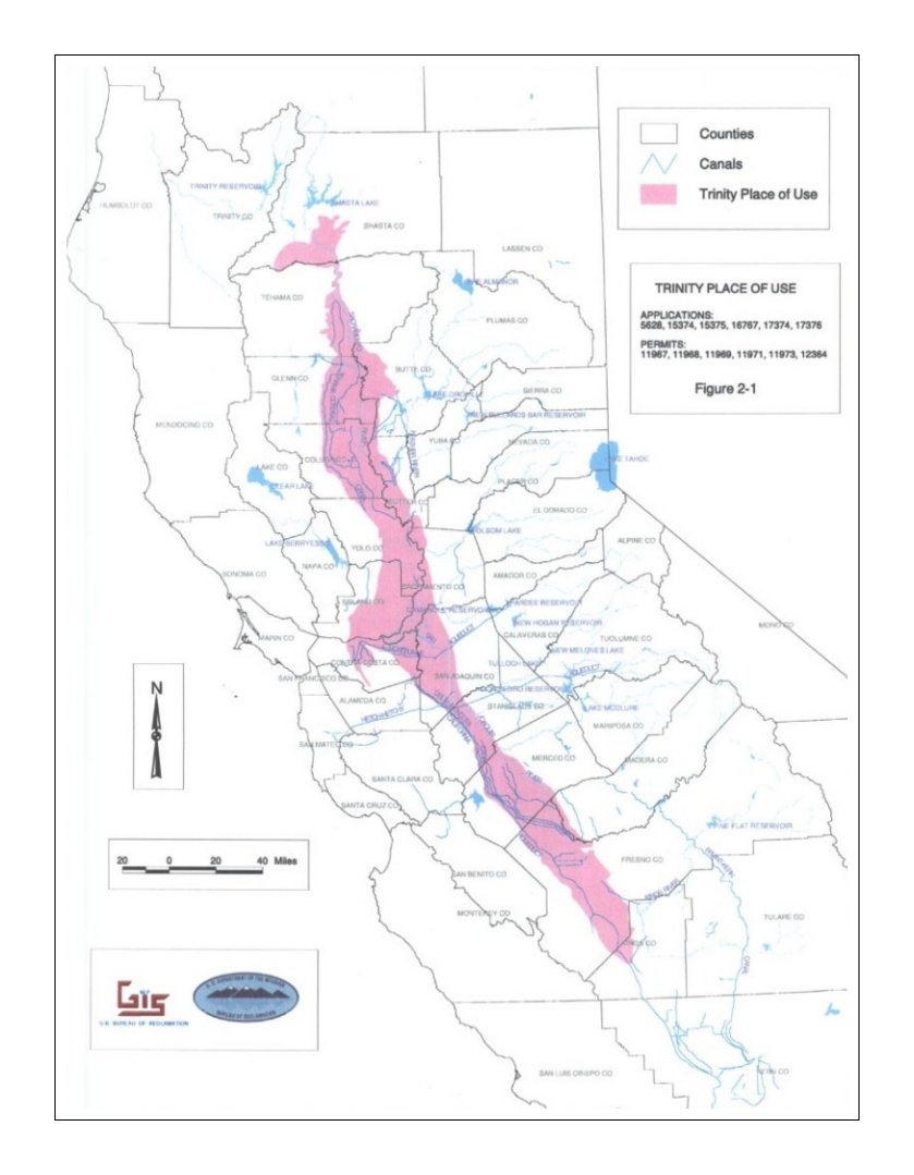
| 2-1 | Trinity Place of Use | 88 KB | figure2-1.jpg | 293 KB | figure2-1.pdf |
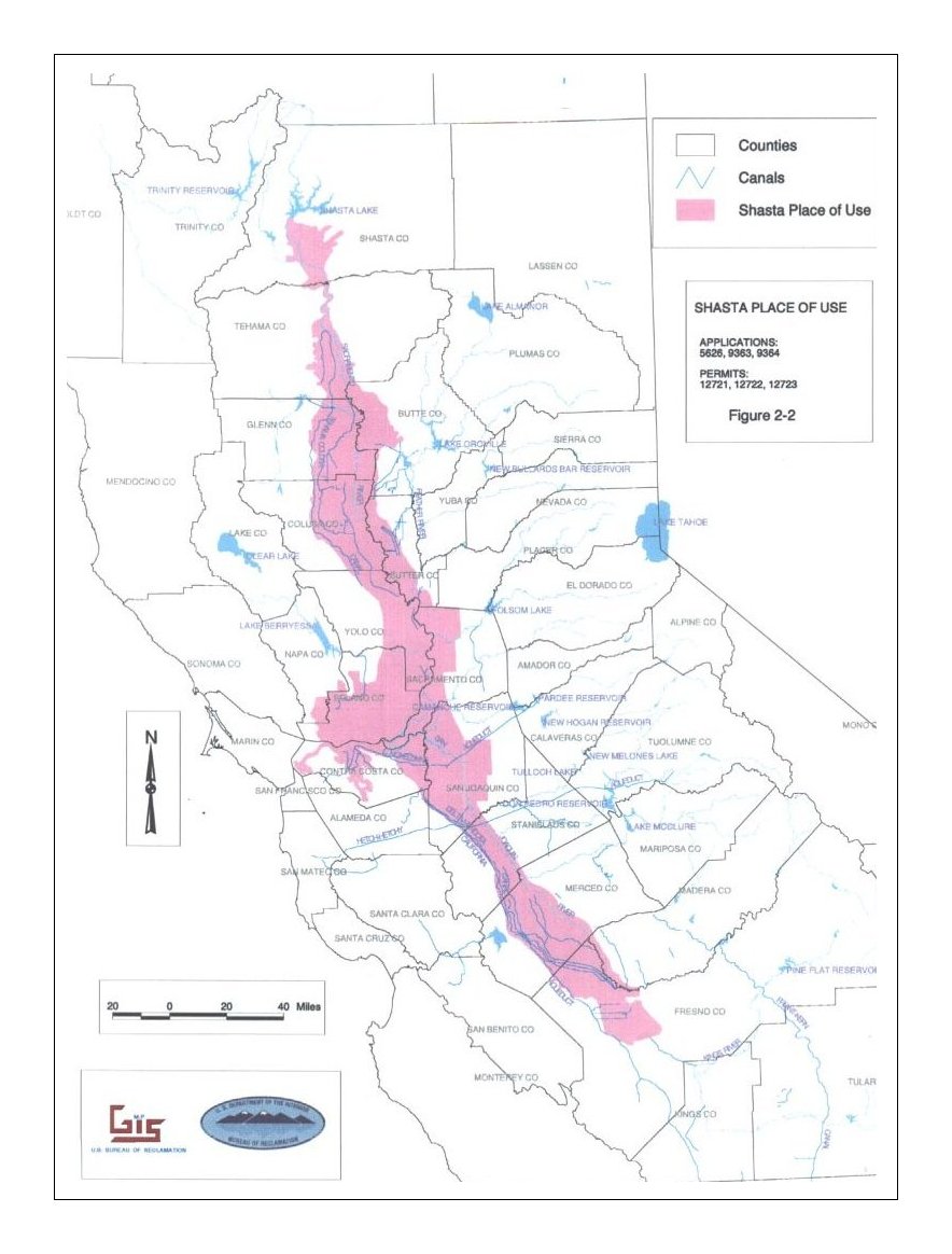
| 2-2 | Shasta Place of Use | 122 KB | figure2-2.jpg | 398 KB | figure2-2.pdf |
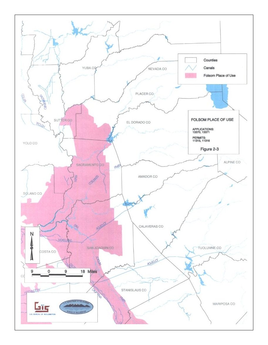
| 2-3 | Folsom Place of Use | 114 KB | figure2-3.jpg | 404 KB | figure2-3.pdf |
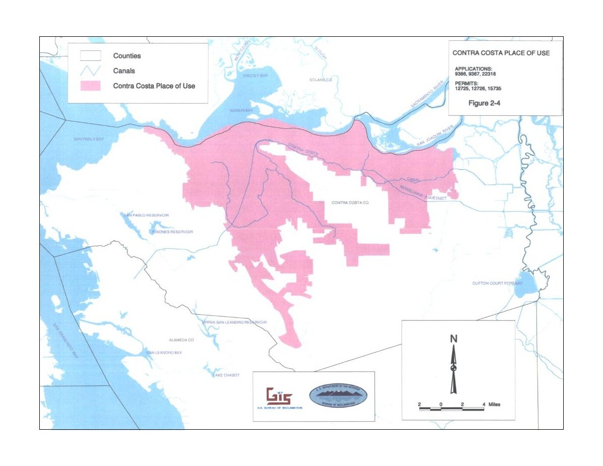
| 2-4 | Contra Costa Place of Use | 114 KB | figure2-4.jpg | 404 KB | figure2-4.pdf |
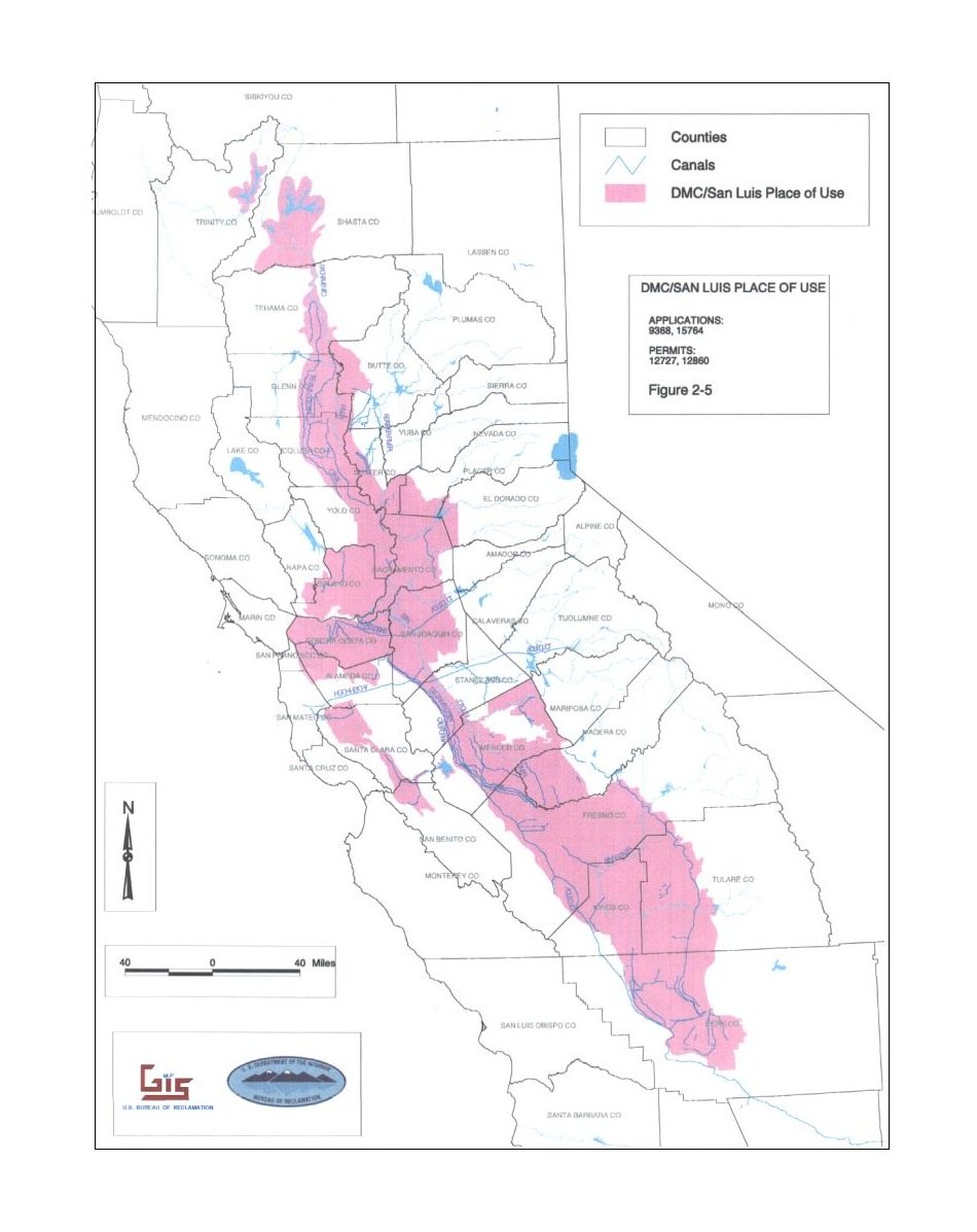
| 2-5 | DMC/San Luis Place of Use | 111 KB | figure2-5.jpg | 371 KB | figure2-5.pdf |
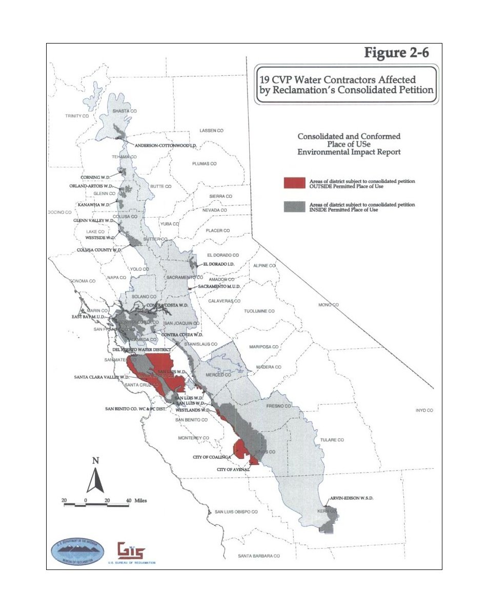
| 2-6 | 19 CVP Water Contractors Affected by Reclamation\'s Consolidated Petition | 123 KB | figure2-6.jpg | 384 KB | figure2-6.pdf |
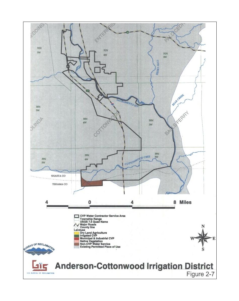
| 2-7 | Anderson-Cottonwood Irrigation District | 140 KB | figure2-7.jpg | 462 KB | figure2-7.pdf |
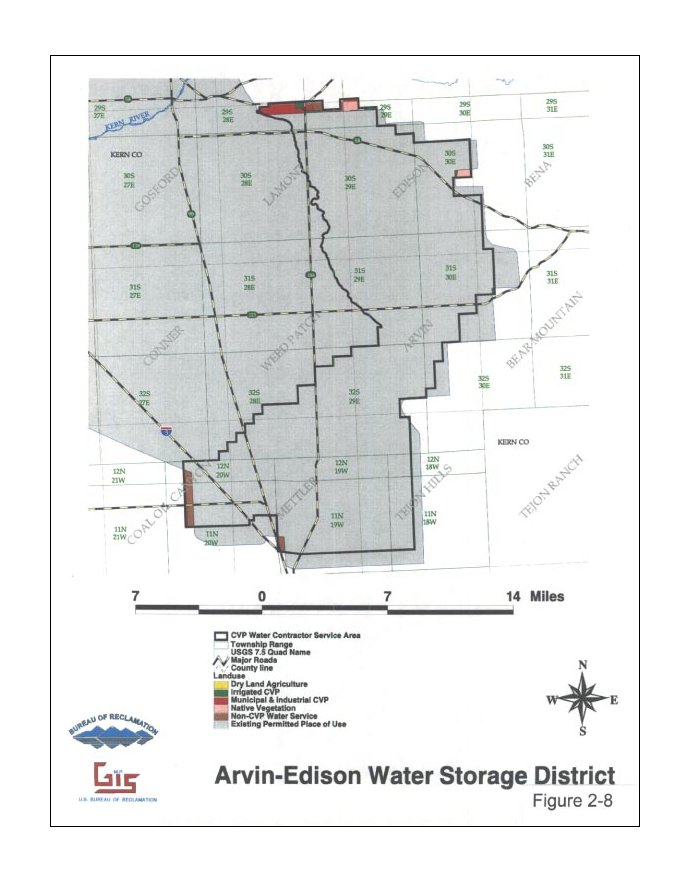
| 2-8 | Arvin-Edison Water Storage District | 74 KB | figure2-8.jpg | 247 KB | figure2-8.pdf |
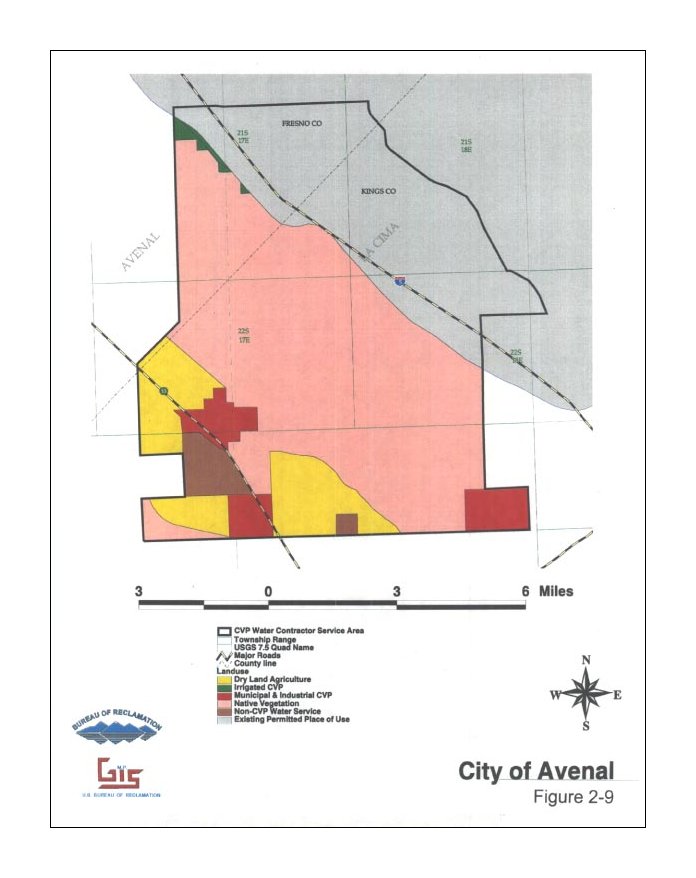
| 2-9 | City of Avenal | 61 KB | figure2-9.jpg | 220 KB | figure2-9.pdf |
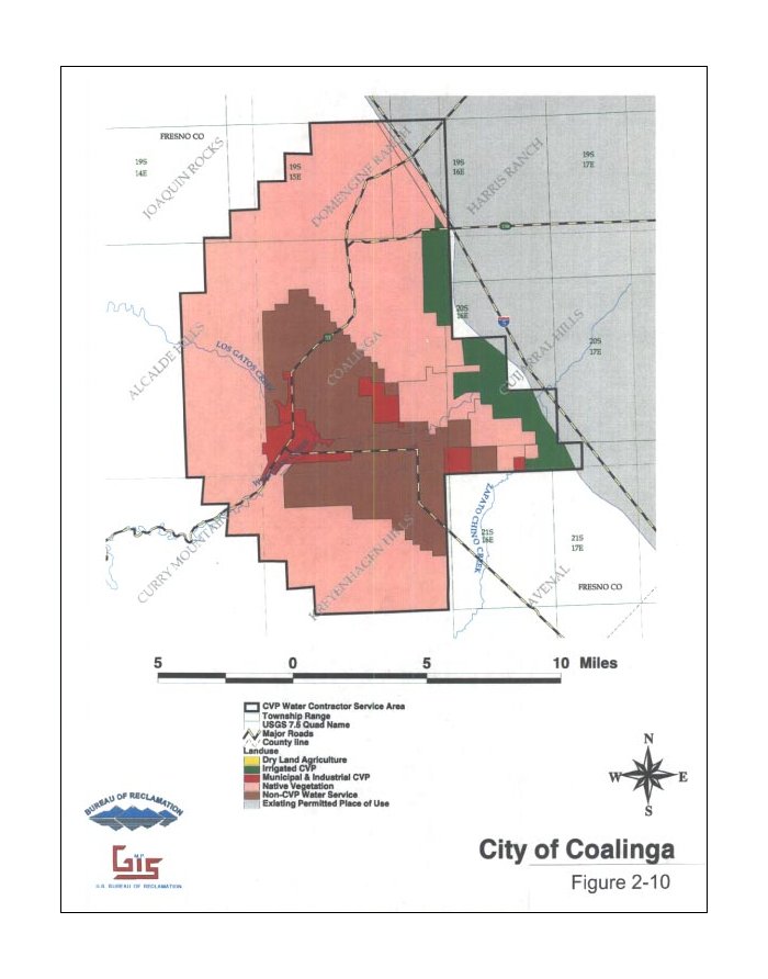
| 2-10 | City of Coalinga | 66 KB | figure2-10.jpg | 250 KB | figure2-10.pdf |
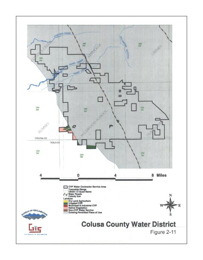
| 2-11 | Colusa County Water District | 70 KB | figure2-11.jpg | 253 KB | figure2-11.pdf |
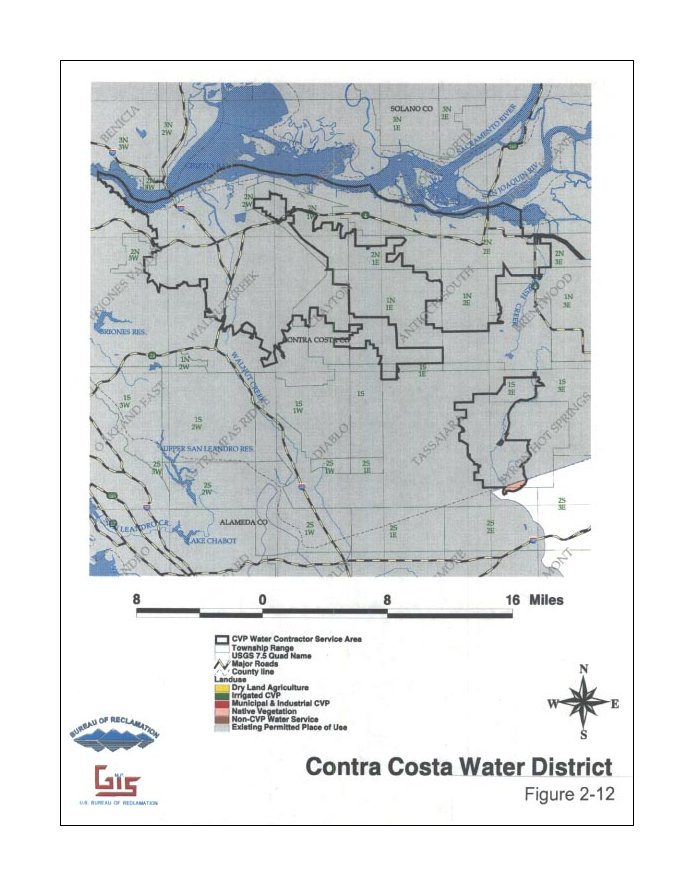
| 2-12 | Contra Costa Water District | 94 KB | figure2-12.jpg | 314 KB | figure2-12.pdf |
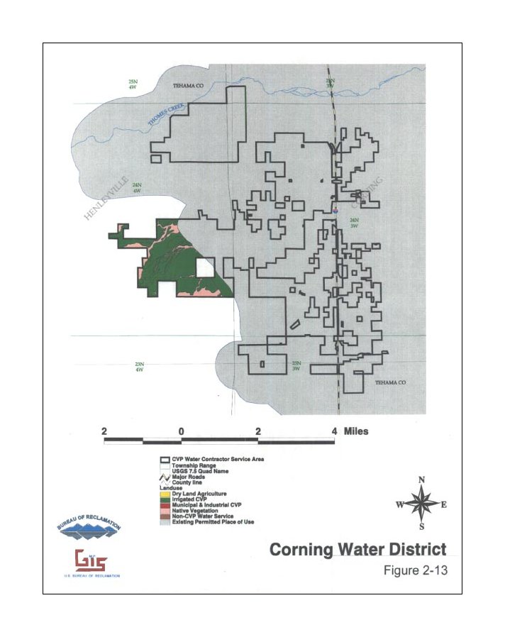
| 2-13 | Corning Water District | 68 KB | figure2-13.jpg | 251 KB | figure2-13.pdf |
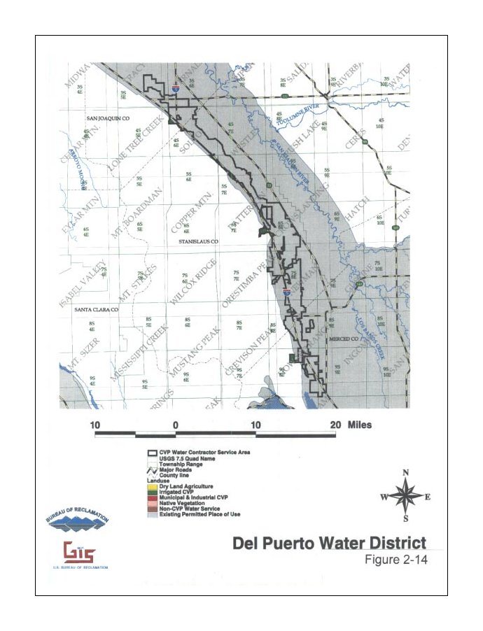
| 2-14 | Del Puerto Water District | 89 KB | figure2-14.jpg | 284 KB | figure2-14.pdf |
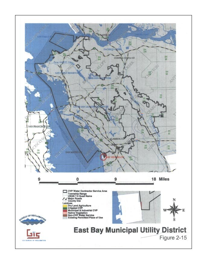
| 2-15 | East Bay Municipal Utility District | 104 KB | figure2-15.jpg | 294 KB | figure2-15.pdf |
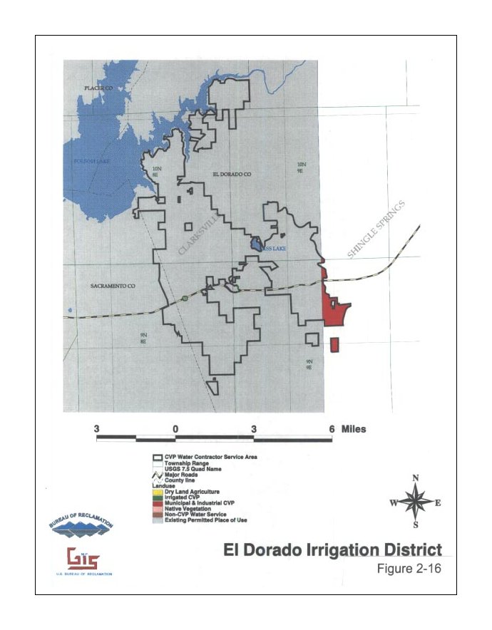
| 2-16 | El Dorado Irrigation District | 69 KB | figure2-16.jpg | 272 KB | figure2-16.pdf |
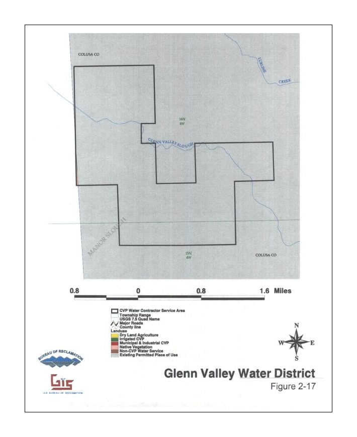
| 2-17 | Glenn Valley Water District | 61 KB | figure2-17.jpg | 223 KB | figure2-17.pdf |
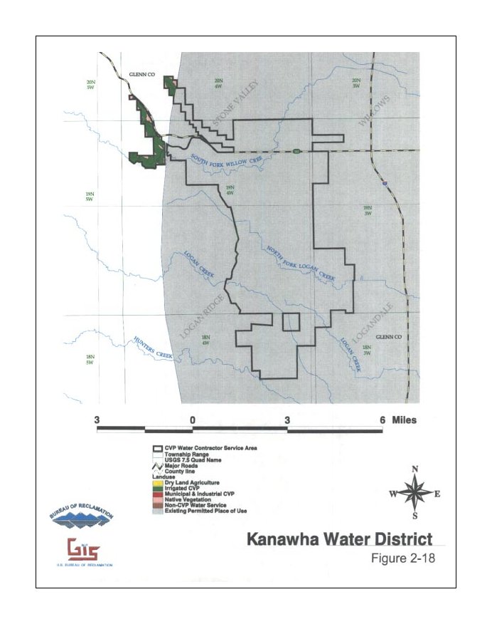
| 2-18 | Kanawha Water District | 68 KB | figure2-18.jpg | 229 KB | figure2-18.pdf |
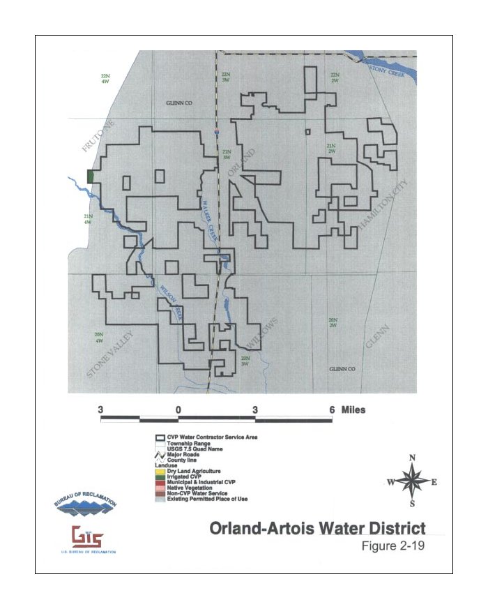
| 2-19 | Orland-Artois Water District | 73 KB | figure2-19.jpg | 237 KB | figure2-19.pdf |
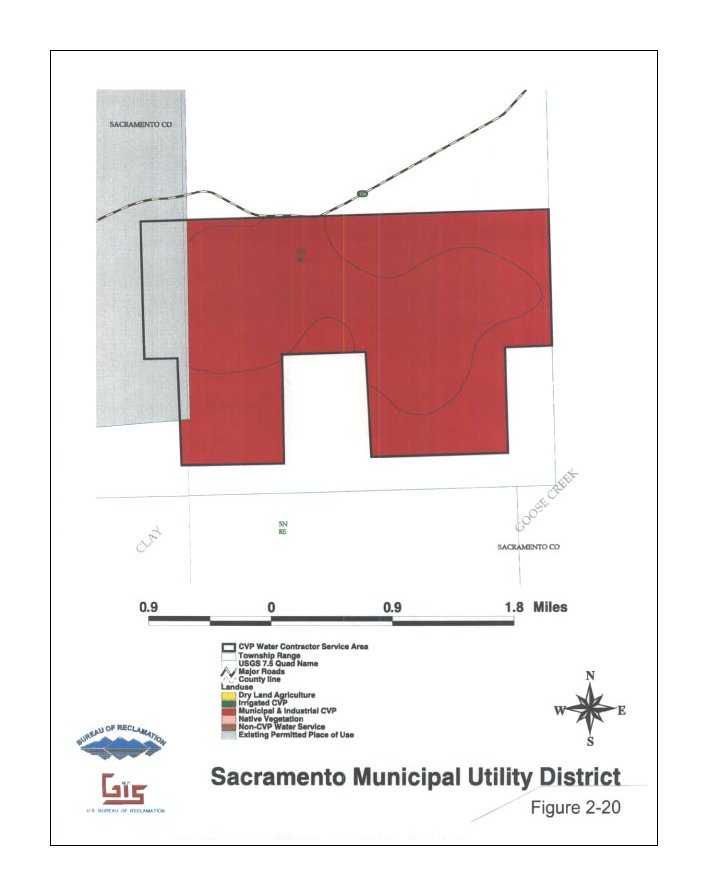
| 2-20 | Sacramento Municipal Utility District | 47 KB | figure2-20.jpg | 164 KB | figure2-20.pdf |
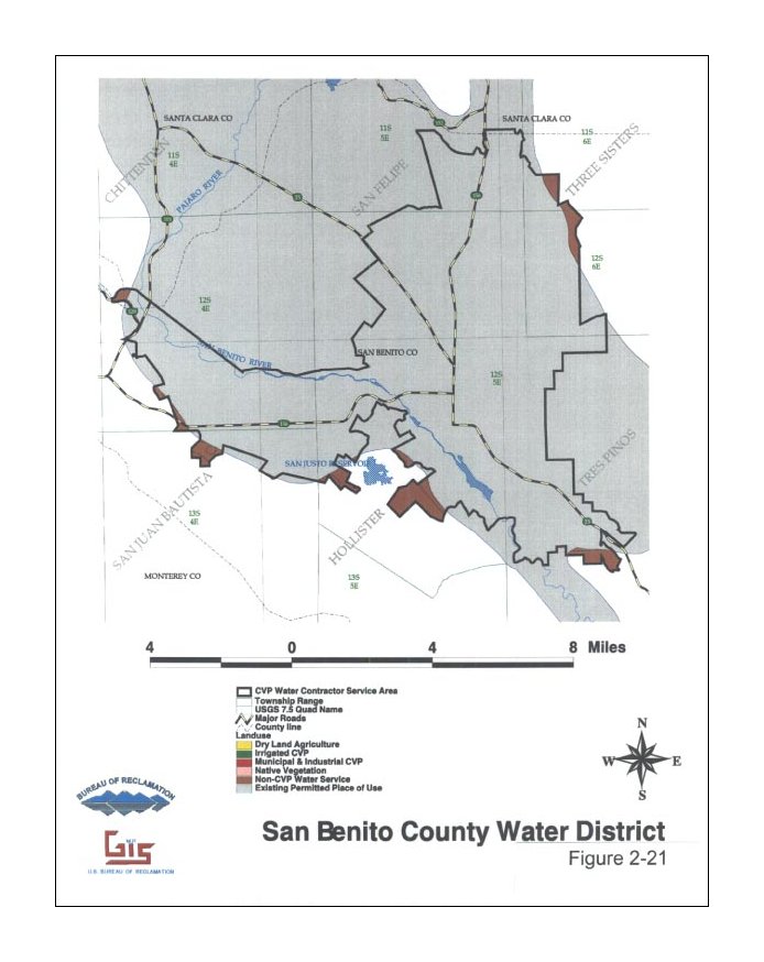
| 2-21 | San Benito County Water District | 74 KB | figure2-21.jpg | 249 KB | figure2-21.pdf |
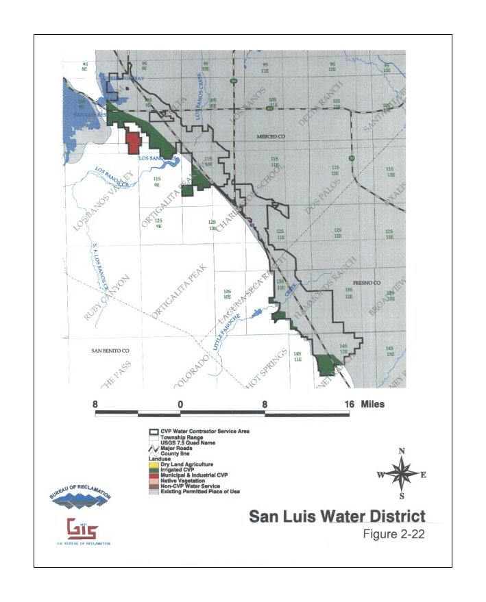
| 2-22 | San Luis Water District | 78 KB | figure2-22.jpg | 273 KB | figure2-22.pdf |
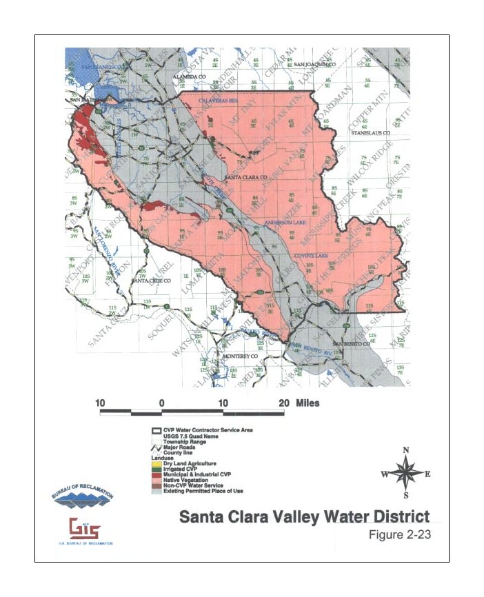
| 2-23 | Santa Clara Valley Water District | 103 KB | figure2-23.jpg | 339 KB | figure2-23.pdf |
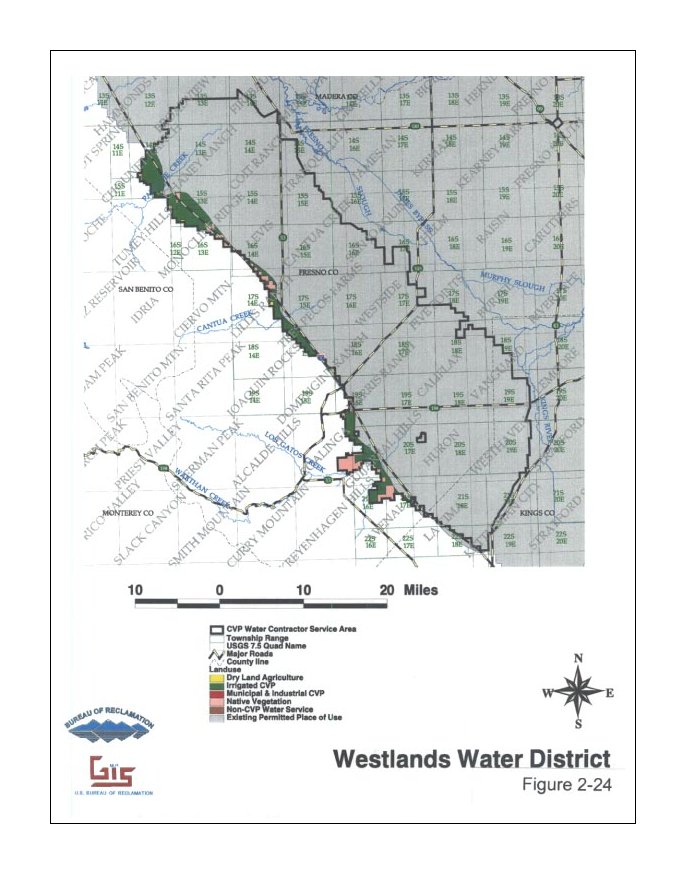
| 2-24 | Westlands Water District | 95 KB | figure2-24.jpg | 306 KB | figure2-24.pdf |
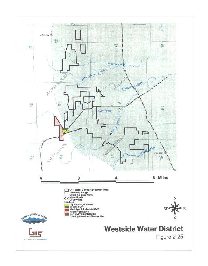
| 2-25 | Westside Water District | 81 KB | figure2-25.jpg | 293 KB | figure2-25.pdf |