Guadalupe River Watershed Mercury TMDL
Ten Year Report / Background / Mine Sites / Reservoirs / Monitoring / TMDL Documents
New - April 2024 Report on 2021 Fish Mercury Data from Select Reservoirs
In 2021, the State Water Resources Control Board’s Safe to Eat Workgroup (“STEW”) sampled fish from many reservoirs to assess their contaminant concentrations, particularly mercury. The San Francisco Bay Regional Water Quality Control Board contributed funds to this program for additional fish collection and mercury analysis from five reservoirs throughout the San Francisco Bay region—Calero Reservoir, Camden Percolation Pond North, Lafayette Reservoir, Shadow Cliffs Reservoir, and Soulajule Reservoir.
For all 2021 data, small prey fish and larger sport fish caught in either Calero and Soulajule Reservoirs had higher mercury concentrations than fish from the other reservoirs. The higher fish tissue concentrations in Calero and Soulajule Reservoirs are likely caused by the impact of upstream mercury mines. However, it is important to note that large sport fish tissue mercury concentrations in all five reservoirs were higher than the Statewide Sport Fish Mercury Water Quality Objective. Only prey fish caught in Calero and Soulajule Reservoirs exceeded the Statewide Prey Fish Mercury Water Quality Objective.
The Water Board has developed a Ten Year Report describing TMDL implementation actions as well as subsequent water quality and fish tissue monitoring resulting from the Guadalupe River Watershed Mercury TMDL. The report has an executive summary with relevant highlights.
- Ten Year Implementation Status of the Guadalupe River Watershed Mercury TMDL
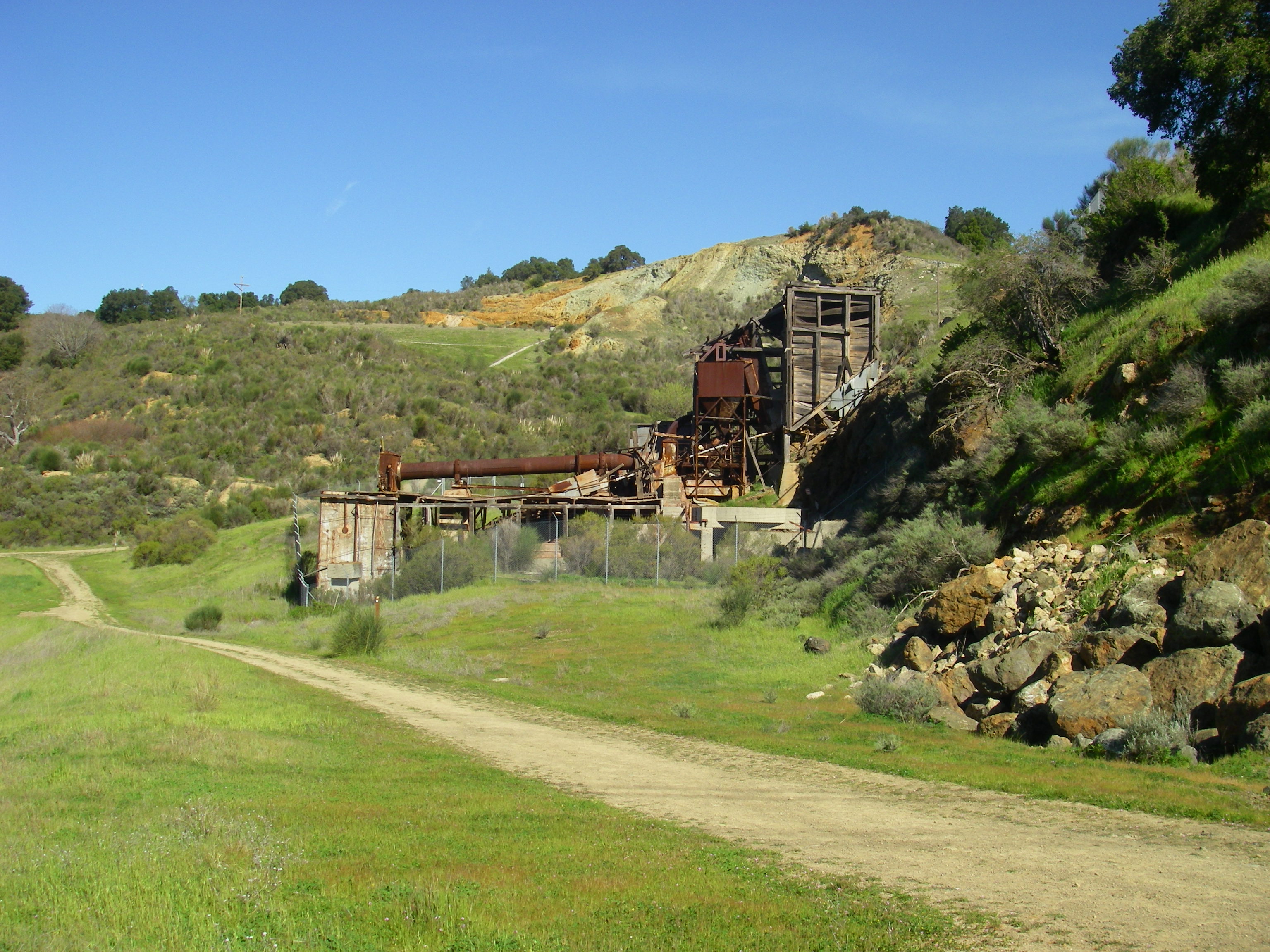
- Table A-1. Cleanup Priority Rankings at Almaden Quicksilver County Park
TMDL Implementation Status (updated June 2019) This update covers implementation actions at mercury mine sites, oxygenation to suppress methylation of mercury in reservoirs and lakes, and monitoring. As planned, we started implementation at the top of the watershed by requiring mine site owners to evaluate and report on the potential for mining waste to erode from their properties. These reports are posted below. Electronic versions of the following documents are available upon request. However, in accordance with Section 11546.7 of the California Government Code, electronic versions cannot be posted online as they do not meet specified accessibility standards. For an electronic copy of the order, please contact the staff person listed at the bottom of this web page. The following erosion control work is underway:
Guadalupe Rubbish Disposal Company
Santa Clara County Department of Parks and Recreation
Midpeninsula Regional Open Space District
See next section (Reservoirs – Dam Seismic Strengthening) regarding additional mercury cleanup and erosion control. Dam Seismic Strengthening California dam safety is regulated by the California Department of Water Resources, Division of Safety of Dams (DSOD). In compliance with DSOD, Valley Water, formerly the Santa Clara Valley Water District ("Water District"), had their dams inspected. Engineers determined that several dams—of reservoirs subject to the TMDL—require strengthening. These dam construction projects may increase mercury methylation unforeseen during TMDL development. The Water Board recommends mitigation for that impact by surveying dewatered areas for mercury hotspots and possibly removing or capping sediment hotspots (details in the Water Board letters below).
Mercury-laden mining wastes upslope or upstream of reservoirs have been and will continue to be addressed to reduce mercury in reservoirs. Almaden Reservoir: Cleanup actions are already completed in areas of Almaden Quicksilver County Park that drain to Almaden Reservoir. Those cleanups also protect Calero Reservoir, which receives mining wastes from Almaden Reservoir via canal. Guadalupe Reservoir: There are nearly 50 mining waste features above Guadalupe Reservoir. In 2018, Water Board staff used a portable x-ray fluorescence (XRF) mobile metals detector for mercury concentrations and visual assessment of erosion. Reservoir dewatering for dam seismic strengthening may provide an opportunity for coordinated cleanup of upland mining wastes and capping of areas of reservoir sediment with elevated mercury levels.
Oxygenation to suppress methylation of mercury in reservoirs and lakes: Valley Water, formerly the Santa Clara Valley Water District ("Water District"), continued its voluntary methylmercury production and control studies, which it initiated in 2005. Initially, the Water District tried solar powered circulators, which were effective in suppressing methylmercury production in Lake Almaden but not in Almaden or Guadalupe Reservoirs. Subsequently, the Water District installed more powerful hypolimnetic oxygenation systems in Calero, Guadalupe, and Almaden Reservoirs, and in Stevens Creek Reservoir as a treatment control site not affected by mercury mines. Recent Water District reports are available here and on Valley Water's website.
In 2014 and 2015, low water levels due to the drought interfered with these studies. More information is available in the Water District’s December 2015 biennial report, and previous December 2013 biennial report, and December 2011 biennial report.
Monitoring: The four entities discussed above have established a coordinated monitoring program for methylmercury levels in fish in creeks and Lake Almaden, and mercury loads discharged to San Francisco Bay. The first five-year cycle of monitoring spanned 2011 to 2016 and included severe drought conditions; monitoring and reporting was led by Santa Clara County Parks (see March 2017 Report). Prey fish were monitored at five locations in 2011, 2012, and 2016; consistent trends over time in fish methylmercury concentrations were not found. The mercury loads monitoring occurred in 2015 and provided drought-year loads data; an estimated 6.3 kg of mercury were discharged over the year. Previously, the program submitted two interim reports, the January 2012 and January 2013 annual data reports. The second cycle of coordinated monitoring will span 2018–2023, and Valley Water will lead this effort. The monitoring plan was approved by Water Board staff. In the 2018-2019 wet season, two storms were monitored in accordance with the plan. January 2017 Storm Monitoring: The Regional Monitoring Program (RMP) for San Francisco Bay funded monitoring of mercury loads in Guadalupe River at Highway 101 during a large storm series in January 2017. This one storm series transported an estimated 70 kg of mercury. (There is no mercury data for the larger and more significant storm that occurred in February 2017.) The Coordinated Monitoring Program (see above) will monitor large storms during 2018–2023.TMDL Approved by U.S. EPAU.S. EPA gives final approval to TMDL and Water Quality Objectives for Mercury in the Guadalupe River Watershed TMDL Documents: Previously, the State Office of Administrative Law (OAL) approved the amendment on February 24, 2010, the State Water Board approved the amendment on November 17, 2009, and the Regional Water Board adopted the amendment on October 8, 2008. Electronic versions of the following documents are available upon request. However, in accordance with Section 11546.7 of the California Government Code, electronic versions cannot be posted online as they do not meet specified accessibility standards. For an electronic copy of the order, please contact the staff person listed at the bottom of this web page.
Due to the size of the original PDF document (47.98 MB), we have made both the full document and each separate chapter available below for download. All these PDF files were created using Adobe Version 6. If you do not have this version (or higher), you will not be able to view the files. Full Document (47.98 MB) Individual Files (smaller-size documents): Cover Page, Table of Contents, and Executive Summary (1.4 MB) Chapter 1. Introduction (233 K) Chapter 2. Watershed Characterization (15 MB) Chapter 3. Data Summary (2.3 MB) Chapter 4. Estimated Mercury Loads (4.3 MB) Chapter 5. Conceptual Model of Mercury (5.9 MB) Chapter 6. Summary (203 K) Chapter 7. References (233 K) Derivation of Numeric Wildlife Targets for Methylmercury in the Development of a Total Maximum Daily Load for the Guadalupe River Watershed (USFWS 2005) (2.3 MB) Reservoir Sediment Sampling, April 2005 (Tetra Tech, Inc., 203 KB) Draft Project Plan, June 2004 (407 KB) Preliminary Project Definition, August 2004 (45 KB) Links: Santa Clara Valley Water District (home page)
|
||
For more information contact:
Gerardo Martinez
Water Resource Control Engineer
San Francisco Bay Regional Water Quality Control Board
1515 Clay St., Suite 1400
Phone: (510) 622-1015
Fax: (510) 622-2460
E-mail: Gerardo.Martinez@waterboards.ca.gov
