
Petition Requesting Changes in Water Rights of The Department of Water Resources and U.S. Bureau of Reclamation for the California WaterFix Project Hearing
File Transfer Protocol Site Information
The State Water Board developed a secure File Transfer Protocol (FTP) website where parties to the hearing should upload their exhibits and parties can download the exhibits submitted by other parties. Each party on the service list will be provided a party-specific account with a username and password before their exhibit submittal deadline. All parties to the hearing will also have access to a shared account on the FTP site, which will allow parties to view and download other parties' exhibits, but only after the exhibit submittal deadline. The shared account is accessible at https://ftp.waterboards.ca.gov/?u=water fix download&p=waterfix123.
- Opening Statement
- Snug Harbor Resorts Exhibit Identification Index
- Snug Harbor Resorts Revised Exhibit Identification Index - 09/30/2016
- Snug Harbor Resorts Exhibit Identification Index - Revised 12/07/2016
- Snug Harbor Resorts Letter Re: Submission of Exhibit List for Entry into Evidence - 12/15/2016
- Snug Harbor Resorts Exhibit Identification Index - (Received 12/15/2016) Revised 12/30/2016
- Snug Harbor Resorts' Exhibit Identification Index - 3/23/2017
- Snug Harbor Resorts’ Exhibit Identification Index - 5/15/2017
- Snug Harbor Resorts’ Exhibit Identification Index - 5/22/2017
- Snug Harbor Resorts' Letter Re: Submission of Exhibit List for Entry into Evidence and Notice of Withdrawal of Exhibits and Confirmation of Previously Admitted Exhibits - 5/28/2017
- Snug Harbor Resorts' Exhibit Identification Index - 5/28/2017
- Snug Harbor Resorts’ Exhibit Identification Index - 6/8/2017
- Snug Harbor Resorts' Letter Re: Submission of Exhibit List for Entry into Evidence – 7/12/2017
- Snug Harbor Resorts’ Exhibit Identification Index - 7/12/2017
- Snug Harbor Resorts’ Exhibit Identification Index - 11/30/2017
- Snug Harbor Resorts' Exhibit Identification Index - 12/07/2017
- Snug Harbor Resorts’ Exhibit Identification Index - 1/11/2018
- Snug Harbor Resorts’ Errata Statement - 1/11/2018
- Snug Harbor Resorts’ Exhibit Identification Index - 3/16/2018
- Snug Harbor Resorts’ Exhibit Identification Index - 4/16/2018
- Snug Harbor Resorts’ Notice of Withdrawal of Exhibits - 4/16/2018
- Snug Harbor Resorts' Exhibit Identification Index - 4/18/2018
- Snug Harbor Resorts’ Exhibit Identification Index - 4/25/2018
- Snug Harbor Resorts’ Exhibit Identification Index - 7/16/2018
- Snug Harbor Resorts, LLC Exhibit Identification Index- 8/28/18
Part 1 - Snug Harbor Resorts, LLC
| Exhibit No. | Exhibit Description | Date Accepted into Evidence* or Withdrawn |
|---|---|---|
| Withdrawn December 30, 2016 | ||
| SHR-5 | 1960 DWR Water Bulletin No. 76 “Delta Water Facilities” | Ruling Dated February 21, 2017 |
| SHR-6 SHR-6f |
1908 description of flows on SS and Sac in dry year-highlighted 1908 Full Description to accompany Survey of the Sacramento River submitted to US House of Representatives: Letter from the Secretary of War. Plus maps |
Ruling Dated February 21, 2017 |
| Withdrawn December 30, 2016 | ||
| SHR-6-2 | 1908 Survey showing middle section of Steamboat Slough | |
| Withdrawn December 30, 2016 | ||
| Withdrawn December 30, 2016 | ||
| SHR-6-5 | 1908 Survey showing area of Courtland | |
| Withdrawn December 30, 2016 | ||
| SHR-6-7 | 1908 Survey showing area of Isleton | |
| SHR-7 shr-7largeposter |
2013 Water Portfolio Inflow Outflow Delta (screen print) larger sizeSHR-7detail includes pie charts showing graphically the unaccounted for flow data - Withdrawn 12/30/2106 (SHR-7large) | |
| SHR-9 | 2010 Historical Fresh Water and Salinity Conditions in the Western Sacramento-San Joaquin Delta and Suisun Bay | Ruling Dated February 21, 2017 |
| Withdrawn December 30, 2016 | ||
| SHR-9b | Conclusion statement of SHR-9 | |
| SHR-10 | 1935 Soils Map of the Sacramento San Joaquin Delta Area, Henry G. Knight, Chief, U.S. Department of Agriculture, Bureau of Chemistry and Soils | |
| SHR-11 | Data gaps: study on CDEC missing data by N. Suard 4-8-2014 | |
| SHR-13 SHR-13large |
Data gaps: study on CDEC accuracy poster format and flow chart from CDEC screen prints | |
| SHR-16 | Resolution No 68-16 SWRCB Statement of Policy with Respect to Maintaining High Quality of Waters in California | |
| SHR-17 | Map of Delta area water rights (screen print from Waterboards site) Staff Note: Per the Ruling Dated February 21, 2017, Only Slide One is Admitted into the Evidentiary Record | Ruling Dated February 21, 2017 |
USGS survey of Water Supply, Plate 5 - Withdrawn 12/30/2016 |
Withdrawn December 30, 2016 | |
| SHR-20 | Slide set of water quality issues in the North Delta with photos by N.Suard | |
| SHR-21 | Slides for arsenic in groundwater questions-modeling | Ruling Dated February 21, 2017 |
| SHR-22 | Drinking water and salinity | |
| SHR-23 | Chart of minimum flows with Tunnels operating; information not provided by DWR | |
| SHR-23b | Information on flow data gaps for March 2014, sent to USACE | |
| SHR-24 | Graphic of aquifer recharge (screen print from BDCP docs) | Ruling Dated February 21, 2017 |
| Withdrawn December 30, 2016 | ||
| SHR-26 | USGS Analysis on the Occurrence of Arsenic in Ground-Water 2000 | Ruling Dated February 21, 2017 |
| SHR-27 | SWRCB, Division of Water Quality Gama program: Arsenic | Ruling Dated February 21, 2017 |
| SHR-28 | 2005 Delta Region Drinking Water Quality Management Plan | Ruling Dated February 21, 2017 |
| SHR-29 | Anti-degredation policy | Ruling Dated February 21, 2017 |
| Withdrawn December 30, 2016 | ||
| SHR-31 | Screen print, current SWRCB flow requirements-SWRCB Resolution No. 2010-0039 | |
| SHR-31f | SWRCB full documentSHR | |
| SHR-32 | Over-allocation of flows from the Sacramento River-screen print | |
http://iopscience.iop.org/article/10.1088/1748-9326/9/8/084012/pdf - Withdrawn 12/30/2016 |
Withdrawn December 30, 2016 | |
| SHR-34 | 2005 USGS Study of Arsenic in drinking water in the Central Valley, Page 27 map | |
| SHR-34f | Full study | Ruling Dated February 21, 2017 |
| SHR-35 | 2011 USGS Study of Arsenic in drinking water in the Central Valley, page 38 map | |
| SHR-35f | Full study | Ruling Dated February 21, 2017 |
| SHR-39e | DSM2 hydrology and bathymetry data timeline and with addition of missing subsurface flow diversion structures |
|
| SHR-39wf | WF map of DSM2 grid | Ruling dated February 21, 2017 |
| SHR-39wf2 |
WF map of DSM2 with elevation and bathymetry updated 2016 Staff Note: Per the Ruling Dated February 21, 2017, Only SHR-39wf is Admitted into the Evidentiary Record |
|
| SHR-40 | Bathymetry development presentation slides by Aaron Blake, USGS | |
| SHR-40f | "Garbage in, garbage out" 2007 | |
| Withdrawn December 30, 2016 | ||
| SHR-42 | Map of Bench Studies on Steamboat Slough under BDCP/CalFed | |
| SHR-43 | 2016 DSM2 Bathymetry update slide | |
| SHR-50 | Tidal and River Datums in the Sacramento River | |
| Withdrawn December 30, 2016 | ||
| Withdrawn December 30, 2016 | ||
| Withdrawn December 30, 2016 | ||
| SHR-66 | Yolo Bypass Salmonid Habitat Restoration Implementation Plan | |
| Withdrawn December 30, 2016 | ||
| Withdrawn December 30, 2016 | ||
| Withdrawn December 30, 2016 | ||
| Withdrawn December 30, 2016 | ||
| SHR-75 | Timeline and history of uses of property at Snug Harbor | |
| SHR-76 | Statement of Permits and water rights & use | |
| SHR-77 | Graph of drinking water quality decline-SHR example | Ruling Dated February 21, 2017 |
| Withdrawn December 30, 2016 | ||
| Withdrawn December 30, 2016 | ||
| SHR-80 | CALFED timeline & Water Exports | |
| SHR-81 | Location in NorCal-map | |
| SHR-82 | Well and water quality data for SHR (example of incorrect SWRCB data) | |
| SHR-83 | Screen print of GeoTrackerGama map of Public Water Systems in Bay and Delta area | |
| SHR-84 | Bottleneck on Steamboat Slough and channel bench impacts | |
| SHR-101 | Powerpoint used in Part1 hearing: Overview of WaterFix | |
| SHR-102 | Powerpoint used in Part 1 hearing: Tunnel / Engineering Note: Per the Ruling Dated February 21, 2017, Only Slide Twenty Seven is Admitted into the Evidentiary Record |
Ruling Dated February 21, 2017 |
| SHR-103 | Powerpoint used in Part 1 hearing: Operations-impacts to water, navigation, flows Staff Note: Per the Ruling Dated February 21, 2017, Only Specific Slides are Admitted into the Evidentiary Record |
Ruling Dated February 21, 2017 |
| SHR-104 | Powerpoint used in Part 1 hearing: Modeling Staff Note: Per the Ruling Dated February 21, 2017, Only Specific Slides are Admitted into the Evidentiary Record |
Ruling Dated February 21, 2017 |
| SHR-105 | Policy statement on behalf of Snug Harbor Resorts, LLC | |
| SHR-106 | Powerpoint of SHR and North Delta photos | |
| SHR-107 | Opening statement for Case in Chief | |
| SHR-108 | Case in Chief for Snug Harbor Resorts, LLC | Ruling Dated February 21, 2017 |
| SHR-109 | Statement of qualifications witness Nicole S. Suard | |
| SHR-110 | Copy of Protest form filed | |
| Withdrawn December 30, 2016 | ||
| SHR-203 | List of links for History of Steamboat Slough and salmon migration | |
| SHR-204 | Travel to Sacramento Via Delta Waterways: Steamboat Slough focusVideo: http://snugharbor.net/old_sacramento_river-video.html | |
| SHR-205 | Hall Irrigation map of the Delta | Ruling Dated February 21, 2017 |
| SHR-206a | 1982 Geologic Maps of the Sacramento-San Joaquin Delta by Brian F. Atwater “Courtland” (Upper Steamboat, Sutter Slough) | |
| SHR-206b | 1982 Geologic Maps of the Sacramento-San Joaquin Delta by Brian F. Atwater “Isleton” (Steamboat Slough by Snug Harbor) Notations added | |
| SHR-206c | 1982 Geologic Maps of the Sacramento-San Joaquin Delta by Brian F. Atwater “Rio Vista” (Steamboat Slough and Sacramento River Confluence) | |
| Withdrawn December 30, 2016 | ||
| SHR-209 | 1873 Board of Commissioners on Irrigation, Map of the San Joaquin, Sacramento and Tulare Valleys | Ruling Dated February 21, 2017 |
| SHR-210 | 1895 Steamboat Slough map showing Hogs Back and “Charleston” island (portion of map) | Ruling Dated February 21, 2017 |
| SHR-211 | 1945 Central Valley Basin Water Resources Development-USBR | Ruling Dated February 21, 2017 |
| SHR-212 SHR-212a |
Excerpts: 1862 view of Steamboat Slough and Sacramento River by James M. Hutchings, and enlargement of one graphic from the book | |
| SHR-213 | Excerpts from references to travel on Steamboat Slough in the 1850’s to 1900 - 1935 Paddle Wheel Days in California by Jerry MacMullen highlighted | |
| SHR-214 | 1848 to 1900 Shipwrecks on Steamboat Slough of the Sacramento Delta Region: Summary from 1986 State Lands Commission study of historic Shipwrecks in the North Delta Region | |
| SHR-215 | 1930 State Water Plan, Bulletin No. 25, Publications of the Division of Water Resources, Report to the Legislature of 1931 | Ruling Dated February 21, 2017 |
| Withdrawn December 30, 2016 | ||
| SHR-217 | The Settlement Geography of the Sacramento-San Joaquin Delta, , John Thompson, December 1957 | |
| Withdrawn December 30, 2016 | ||
| SHR-220 | 1923 Steamboat Captain’s map of the Sacramento River Delta landings (section of a 60” long map) | |
| SHR-221 | 1908 Sacramento River and Steamboat Slough minimum flows | |
| SHR-222 | Excerpts from James M. Hutchings 1862 book on “Scenes of Wonder and Curiosity”, including review of quantity of salmon on the Sacramento River. 22 pages | |
| SHR-223 | 1975 Bulliten No 192 “Plan for Improvement of Delta Levees” (exerpt of) | |
| Withdrawn December 30, 2016 | ||
| Withdrawn December 30, 2016 | ||
| SHR-252 | Map of Stimulated Wells, FrackTracker | |
| SHR-253 | 2014 low tide photos: impacts | |
| Withdrawn December 30, 2016 | ||
| SHR-255 | Surplus Water Graphic | |
| SHR-256 | 2007 BDCP Conservation Strategy (notation for Steamboat Slough) | |
| Withdrawn December 30, 2016 | ||
| Withdrawn December 30, 2016 | ||
| SHR-319 | Timeline of Actions Affecting Water Quality | |
| SHR-350 | DWR chart provided via email on 8-25-16, received 8-26-16 | Ruling Dated February 21, 2017 |
| SHR-351 | NSS statement of receipt of DWR chart | |
| SHR-352 | DWR chart provided bia email on 8-26-16 | |
| Withdrawn December 30, 2016 | ||
| SHR-381 | Critical Year comparison | |
| Withdrawn December 30, 2016 | ||
| SHR-386 | Water Code Part 1.5 regarding 5-year reporting requirement: Delta outflows | |
| SHR-388 | A&E Delta Outflow from 8-29-16 | |
| SHR-389 | Steamboat Slough Data gap 2016 | |
| SHR-389-errata | Steamboat Slough Data gap 2016 - errata Staff Note: Per the Ruling Dated February 21, 2017, Only Specific Slides are Admitted into the Evidentiary Record |
Ruling Dated February 21, 2017 |
| SHR-390 | Study of water missing flows: "Where did the water go?" | |
| SHR-391 | Mapped New Intakes affecting Delta flows (poster format) | |
| SHR-392 | 2007 Delta Water Quality study-CALFED Bay-Delta Program | |
| SHR-394 | Historical diversion to 2005 – screen print | |
| Withdrawn December 30, 2016 | ||
| Withdrawn December 30, 2016 | ||
| Withdrawn December 30, 2016 | ||
| SHR-398 | USBR-Increase in exports 2010 | |
| SHR-400 | 2013 California Water Plan Update, screen prints review | |
| Withdrawn December 30, 2016 | ||
| SHR-404 | Yolo Bypass restoration map | |
| Withdrawn December 30, 2016 | ||
| SHR-406 | Dayflow 2014 data | |
| SHR-500 | Statement of Verification of Documents Uploaded by N. Suard | |
| Withdrawn December 30, 2016 |
Part 1 - Rebuttal
| Exhibit No. | Exhibit Description | Date Accepted into Evidence* or Withdrawn |
|---|---|---|
| SHR-359 | Review of DSM2 Bathymetry Update data | |
| SHR-360 | Screen Print of CDEC map showing Ryer Island and Steamboat Slough area edited to included locat | |
| SHR-362 | Graphics from flow data provided by DWR located in SHR-350 | |
| SHR-363 | Graphic compiled from DWR-901 and SHR-350 for Monitoring Stations SSS, SUS, SXS, SOI and SRV | |
| SHR-364 | Graphics compiles using screen prints of USGS Rio Vista monitoring station and DWR-650 | |
| SHR-365 | Graphics compiled from online resources to determine sensitive crops | |
| SHR-367 | Graphic comparing flow at monitoring station SSS in September 2015 to EC at that same time | |
| SHR-368 | DWR-316 Salinity Conversion Table with dotted line to show 1 ppt to EC relationship | |
| SHR-369 | CDEC chart showing Peak EC at monitoring station SXS in September 2015 | |
| SHR-370 | CDED and DWR monitoring stations for lower Sacramento River at SOI showing EC Sept | |
| SHR-407 | BDCP Graphic of salinity impact from proposed reduced flows for BDCP conveyance plan. | |
| SHR-502-Staff-Revised
|
Rebuttal Testimony of Nicole Suard – Staff Revised 5/24/2017 |
Part 1 - Sur-Rebuttal
| Exhibit No. | Exhibit Description | Date Accepted into Evidence* or Withdrawn |
|---|---|---|
| SHR-360-Errata | CDEC screen print showing monitoring stations on Steamboat Slough and Sacramento River | Ruling Dated August 10, 2017 |
| SHR-363-Errata | Modeled Projected Drinking Water Quality of Steamboat Slough between the Monitoring Station during low flow months | Ruling Dated August 10, 2017 |
| SHR-363-2 | USGS Sacramento River flow at Rio Vista in 2015 and EC ranges | Ruling Dated August 10, 2017 |
| SHR-363-3 | CDEC chart of EC on Steamboat Slough at station SUS compared to flows of September 2015 | Ruling Dated August 10, 2017 |
| SHR-363-4 | CDEC chart of EC on Steamboat Slough at Station SXS compared to flows of September 2015 | Ruling Dated August 10, 2017 |
| SHR-363-5 | CDEC chart of EC on Sacramento River at station SOI compared to flows of September 2015 | Ruling Dated August 10, 2017 |
| SHR-364 | DWR-650 compared to USGS flow chart for Sacramento River at Rio Vista in September, October 2015 | Ruling Dated August 10, 2017 |
| SHR-504 | Written Sur-Rebuttal Testimony of Nicole S Suard for AHR | Ruling Dated August 10, 2017 |
| SHR-504-Errata | Sur-rebuttal testimony of Nicole S Suard for SHR | Ruling Dated August 10, 2017 |
| SHR-715 | Ruling Dated August 10, 2017 | |
| SHR-716 | November 2015 Suard slides from presentation on water quality impacts from tunnels plans | Ruling Dated August 10, 2017 |
| SHR-723 | March 2009 Suard comments on BDCP to Ms. Delores Brown | Ruling Dated August 10, 2017 |
| SHR-730 | June 17, 2010 BDCP Physical Modeling Update | Ruling Dated August 10, 2017 |
Part 2
| Exhibit No. | Exhibit Description | Date Accepted into Evidence* or Withdrawn |
|---|---|---|
| SHR-2-1 | Nicole Suard Qualifications | Ruling Dated June 18, 2018 |
| SHR 2-11 | Nicole Suard testimony | |
| SHR-2-11-errata | Nicole Suard testimony - errata | |
| SHR-2-11-errata 2 | Nicole Suard testimony - errata 2 | Ruling Dated June 18, 2018 |
| Not accepted per Ruling Letter dating January 4, 2018 | ||
| Withdrawn per Letter dated April 16, 2018 | ||
| SHR-2-17 | Summary of Impacts from BDCP 2013 as a reference example | Ruling Dated June 18, 2018 |
| SHR-2-19 | Portion of Sacramento San Joaquin Delta Atlas by DWR, 1978 accessed online at http://water.ca.gov | Ruling Dated June 18, 2018 |
| Not accepted per Ruling Letter dating January 4, 2018 | ||
| SHR-2-21-F | Excerpts of the Delta Vision Context Memo 2017 | Ruling Dated June 18, 2018 |
| SHR 2-22 | CF&W Yolo Bypass Planning Presentation 2008-12 Million Recreation Users Per Year in The Delta | |
| Withdrawn per Letter dated April 16, 2018 | ||
| SHR-2-24 | 1937 Snug Harbor from the air | Withdrawn per Letter dated April 16, 2018 |
| SHR-2-25 | Delta Flood Timeline | Ruling Dated June 18, 2018 |
| SHR-2-26 | A Special Report on Fishing and Boating | Ruling Dated June 18, 2018 |
| SHR-2-28-2 | The Directionally Challenged DWR consultants: a review of the correct names for North Delta Islands and Waterways | Not accepted per Ruling Letter dating January 4, 2018 |
| SHR-2-31 | Delta History & Water Conveyance Plans. Slide set compiled by N. Suard 2009-2014, updated 2017 | Ruling Dated June 18, 2018 |
| Withdrawn per Letter dated April 16, 2018 | ||
| SHR-2-102 | Draft Development of Flow Criteria for the Sacramento-San Joaquin Delta Ecosystem | Ruling Dated June 18, 2018 |
| SHR-2-103 | Developing Flow Prescriptions for the Sacramento-San Joaquin Delta | Ruling Dated June 18, 2018 |
| SHR-2-104 | Delta Recreation incorrect data: Section 18, Draft Delta Plan EIR Program Report | Ruling Dated June 18, 2018 |
| SHR-2-105 | Where's the Water? Power Point dated 5-15-14 by N. Suard review of noted flow issues in the North Delta |
|
| Withdrawn per Letter dated April 16, 2018 | ||
| Withdrawn per Letter dated April 16, 2018 | ||
| SHR-2-108 | Water Quality Slide Show-Waterboard | Ruling Dated June 18, 2018 |
| SHR-2-109 | Scientific Basis Report in Support of New and Modified Requirements for Inflows from the Sacramento River et al 2017 | Ruling Dated June 18, 2018 |
| Withdrawn per Letter dated April 16, 2018 | ||
| Withdrawn per Letter dated April 16, 2018 | ||
| Withdrawn per Letter dated April 16, 2018 | ||
| SHR-2-113 | Reclamation Water Supply & Yield Studies, pages 13,22,34,37,52 | Ruling Dated June 18, 2018 |
| Withdrawn per Letter dated April 16, 2018 | ||
| SHR-2-115 | Example of CalTrans detour route Memorial Day Weekend 2011 https://youtube/04BBZvoU40Y | Ruling Dated June 18, 2018 |
| Withdrawn per Letter dated April 16, 2018 | ||
| SHR-2-211 | 1852 map and Sketches and locations of Steamboat Slough in 1850's: Island names noted | Ruling Dated June 18, 2018 |
| SHR-2-211R | 1865 Delta Reference Map | Ruling Dated June 18, 2018 |
| SHR-2-212 | Travel to Sacramento Via Delta Waterways in 1850: Steamboat Slough Focus: slide set compiled by N. Suard with references | Ruling Dated June 18, 2018 |
| SHR-2-215 | Snug Harbor access and CalTrans: history of transportation issues 2000 to current | Ruling Dated June 18, 2018 |
| Withdrawn per Letter dated April 16, 2018 | ||
| Withdrawn per Letter dated April 16, 2018 | ||
| SHR-2-219 | 1908 Survey of the Delta, Steamboat Slough and lower Sacramento maps; drought flows on Steamboat Slough | Ruling Dated June 18, 2018 |
| SHR-2-219-2 | 1908 Survey of the Sacramento River, notes to assist in reading the survey maps: scan of section of notes | Ruling Dated June 18, 2018 |
| SHR-2-219-3 | 1908 Survey of the Sacramento River, Sheet 11, with notes added in blue: Sacramento River and upper Steamboat Slough Confluence (unclear map) | Ruling Dated June 18, 2018 |
| SHR-2-219-4 | 1908 Survey of the Sacramento River, Sheet 12, with notes added in blue: Steamboat Slough at Hog Back (unclear map) | Ruling Dated June 18, 2018 |
| SHR-2-219-5 | 1908 Survey of the Sacramento River, Sheet 13, with notes added in blue: Steamboat Slough at confluence with lower Sacramento River (unclear map) | Ruling Dated June 18, 2018 |
| SHR-2-220 | 1935 Soil Map of the Delta and 1913 road map | Ruling Dated June 18, 2018 |
| SHR-2-222 | 1945 subdivision map and new homes built | Ruling Dated June 18, 2018 |
| 1935 Soil Map Sacramento San Joaquin Delta by Henry G. Knight, Chief, U.S. Department of Agriculture Bureau of Chemistry and Soil | ||
| SHR-2-224 | 1950's Surplus water plan: Graphic from 1960 Bulletin No 76, Delta Water Facilities |
Ruling Dated June 18, 2018 |
| Withdrawn per Letter dated April 16, 2018 | ||
| Withdrawn per Letter dated April 16, 2018 | ||
| Withdrawn per Letter dated April 16, 2018 | ||
| Withdrawn per Letter dated April 16, 2018 | ||
| SHR-2-231 | Hal Schell book excerpts Delta Dawdling, North Delta focus, Sea Scouts on Steamboat Slough and other photos | Ruling Dated June 18, 2018 |
| SHR-2-233-1 | SHR "Best Small Park" designation and 2003 San Francisco Chronicle article "Ocean views and other wonders of Bay Area campsites" by Tom Stienstra | Ruling Dated June 18, 2018 |
| SHR-2-234 | 2005 NOAA Nautical Chart 18661 Sacramento and San Joaquin Rivers, with notation added | Ruling Dated June 18, 2018 |
| Withdrawn on April 25, 2018 | ||
| Withdrawn on April 25, 2018 | ||
| SHR-2-247 | Unanswered Questions: Prospect Island (Water Weeds Nursery) and impacts to the Delta | Ruling Dated June 18, 2018 |
| Withdrawn per Letter dated April 16, 2018 | ||
| SHR-2-249-errata | Directionally Challenged consultants for DWR, SFEI, PPIC, DSC, NOAA, CalTrans: Wrong maps of the Delta | Ruling Dated June 18, 2018 |
| Withdrawn per Letter dated April 16, 2018 | ||
| Withdrawn per Letter dated May 4, 2018 | ||
| SHR-2-251-errata | Low flows impacts to drinking water and irrigation water, docks, boating and recreation | Ruling Dated June 18, 2018 |
| SHR-2-252 | Privately Owned Recreation Facilities, by County, Appendix 15A, BDCP Draft EIR/EIS March 2013 | Ruling Dated June 18, 2018 |
| SHR-2-253 | High flows caused by the Oroville maintenance failure by DWR: record flood at SHR: leaseholders, staff costs. Repairs to well, banks, roads | Ruling Dated June 18, 2018 |
| SHR-2-254 | Effect of Tides, River Flow, and Gate Operations on Entrainment of Juvenile Salmon into the Interior Sacramento-San Joaquin River Delta by R. Perry et al. 2015 | Ruling Dated June 18, 2018 |
| SHR-2-255 | How Delta Cross Channel operations affect Steamboat Slough Flows. | Ruling Dated June 18, 2018 |
| SHR-2-256 | Historical Woody Forests of the Delta: screen prints of historical sketches, maps and photos | Ruling Dated June 18, 2018 |
| SHR-2-257 | Impacts to Recreation and Fishing from restoration projects at Prospect and Liberty Islands | |
| SHR-2-258 | Cache Slough Complex Impacts | Ruling Dated June 18, 2018 |
| Withdrawn per Letter dated April 16, 2018 | ||
| SHR-2-261 | Example-Wells and Septics impacts from Tunnel and Forebay Construction | Ruling Dated June 1, 2018 |
| SHR-2-262 | Noise carries in the Delta-slide showing location and photos of current major electrical construction work on Grand Island creating noise at Snug Harbor | Ruling Dated June 1, 2018 |
| Withdrawn per Letter dated May 4, 2018 | ||
| SHR-2-263-errata | Questions for Panel 2-slides used (20 slides) | Ruling Dated June 18, 2018 |
| Withdrawn per Letter dated May 4, 2018 | ||
| SHR-2-264-errata | Slides used for questioning witnesses regarding impacts to recreation (30 slides) | Ruling Dated June 18, 2018 |
Part 2 - Rebuttal
| Exhibit No. | Exhibit Description | Date Accepted into Evidence* or Withdrawn |
|---|---|---|
| SHR-253 | 2014 Low Tide photos showing impacts from low flows | |
| SHR-701 | Written testimony Part 2 rebuttal, Nicole S. Suard, Esq | |
| SHR-701-R | Written testimony Part 2 rebuttal, Nicole S. Suard, Esq - Corrected by Hearing Staff according to the July 27, 2018 Ruling Letter | |
| SHR-701-R2 | Written testimony Part 2 rebuttal, Nicole S. Suard, Esq (revised on 8/27/18 by SHR) | September 10, 2018 |
| Withdrawn on August 27, 2018 | ||
| Not admitted per Oral Ruling on August 27, 2018 | ||
| Not admitted per Oral Ruling on August 27, 2018 | ||
| SHR-704 | Ca Dept of Conservation 2018 New drilling permit-Staten Island | September 10, 2018 |
| SHR-705 | Ca Dept of Conservation map 610 Oil & Gas wells (North) | September 10, 2018 |
| SHR-706 | Ca Dept of Conservation map 614 Oil & Gas wells (North Delta area) | September 10, 2018 |
| SHR-707 | Online map of North Delta area gas wells and data sources (superseded by SHR-707-errata) | |
| SHR-707-Errata | Online map of North Delta area gas wells and data sources | September 10, 2018 |
| SHR-708 | Excel Database of Ca Dept of Conservation Gas and Oil Wells, North area, with Delta counties highlighted | |
| Not admitted per Oral Ruling on August 27, 2018 | ||
| I |
Withdrawn on August 27, 2018 | |
| Withdrawn on August 27, 2018 | ||
| Withdrawn on August 27, 2018 | ||
| SHR-713 | Proposed new water quality, flow, level and temperature monitoring stations in the North Delta | September 10, 2018 |
| SHR-714 | Map of North Delta roads proposed to be prohibited for construction traffic use | September 10, 2018 |
| Withdrawn on August 27, 2018 | ||
| Not admitted per Ruling Letter dated September 10, 2018 | ||
| Not admitted per Ruling Letter dated September 10, 2018 | ||
| SHR-719 | July 2018 Framework for the Sacramento San Joaquin Delta Update to the Bay-Delta Plan | September 10, 2018 |
| Withdrawn on August 27, 2018 | ||
| SHR-721 | Withdrawn on August 27, 2018 | |
| Withdrawn on August 27, 2018 | ||
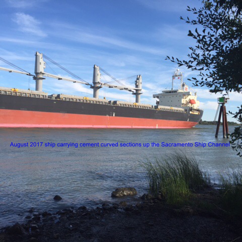
| SHR-724 | Photo of Sacramento River shipping and barge | September 10, 2018 |
Part 2 - Sur-Rebuttal
| Exhibit No. | Exhibit Description | Date Accepted into Evidence* or Withdrawn |
|---|---|---|
* For a complete account of testimony and exhibits that have been admitted into evidence, please see the Ruling Page for the corresponding ruling date and/or Transcript Page for the corresponding transcript date.
