Lagunitas Creek Watershed Sediment TMDL
Electronic versions of the following documents are available upon request. However, in accordance with Section 11546.7 of the California Government Code, electronic versions cannot be posted online as they do not meet specified accessibility standards. For an electronic copy of the order, please contact the staff person listed at the bottom of this web page.
New: The Basin Plan amendment adopting the TMDL was approved by the State Board on November 18, 2014 and by the Office of Administrative Law on March 17, 2015.
- Final Order: R2-2014-0027
June 11, 2014 Water Board Hearing Documents
STAFF SUMMARY REPORT
APPENDICES:
- A. Revised Tentative Resolution with Basin Plan Amendment (Exhibit A)
- B. Revised Proposed Basin Plan Amendment showing changes since March 10, 2014
- C. Staff Report
- D. Response to Comments
- E. Written Comments Received
State Water Board Hearing Documents
- Notice of Opportunity for Public Comment
- Agenda for November 18, 2014 State Board Hearing
- State Board Agenda Item and Draft Resolution
- Final Adopted Resolution (to be posted after State Board hearing)
Background
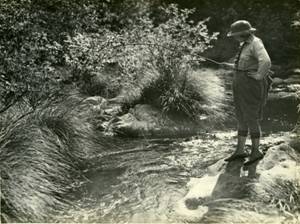
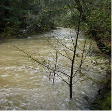
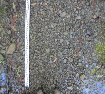
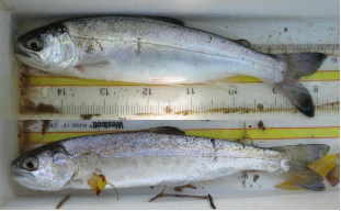
Lagunitas Creek, from its headwaters on Mount Tamalpais to its mouth in Tomales Bay, is the largest watershed in Marin County. It provides critical habitat for coho salmon, steelhead, and California freshwater shrimp, all of which are listed under the federal Endangered Species Act. Habitat simplification and changes in sediment delivery, transport, and storage have contributed to the decline of the salmonid runs. There has been a two-fold or greater increase in sediment supply to Lagunitas creek and its tributaries (Stillwater Sciences, 2010). Channel incision, or down-cutting into its bed, is the primary source of increase in sediment supply, and also a primary agent of channel habitat simplification, and disconnection from its floodplain[*]. Dam construction, development, and management actions have interacted to cause incision/ habitat simplification, and to fundamentally alter channel sediment delivery, transport, and storage. The concentration of sand and fine gravel in the streambed is elevated significantly above the natural background and the streambed is much more mobile during high flows (Cover, 2012). Fine sediment control, channel habitat enhancement, and floodplain restoration projects are needed in concert to restore properly functioning habitat conditions.[*]Also there are fewer large fallen trees in channels as a result of nineteenth century logging, intensive removal of debris from channels, and as a consequence of channel incision (e.g., incised channels are narrow and deep and many fallen trees remain perched above the channel). The lack of large fallen trees in channels is a problem for fish because large trees force pools and bars to form, cause sediment to be sorted into discrete patches (that vary in grain size), and create side channels, islands, and floodplains. |
Studies and Reference Materials
Lagunitas Creek Salmonid Limiting Factors Analysis (Stillwater Sciences, 2008)
Lagunitas Creek Watershed Sediment Budget (Stillwater Sciences, 2010)
Streambed Monitoring Report: 1995-2007 (Balance Hydrologics, 2010)
Linkages between Sediment Supply and Streambed Conditions (Cover, 2012)
For more information, contact:
Lisa Hunt
Water Resources Control Engineer
San Francisco Bay Regional Water Quality Control Board
1515 Clay St., Suite 1400
Phone: (510) 622-2373
Fax: (510) 622-2460
E-mail: Lisa.Hunt@waterboards.ca.gov
