Water Quality Monitoring
 |
Water quality monitoring is important for many reasons. Monitoring results allow the Water Board to set program priorities and budgets as well as report our successes and challenges to our sister agencies at the regional, state, and federal levels. The Bay Area is fortunate to have monitoring partners who are committed to excellence in this ongoing work. Many of the Water Boards' water quality protection programs rely on monitoring data, which we and other agencies collect for our own use and also make available to the public. This page details many of our water quality monitoring efforts and includes links to water quality information in our area. |
Announcements
The Surface Water Ambient Monitoring Program (SWAMP) was created in 2000. It fulfills a State legislative mandate for a unifying program that coordinates all water quality monitoring conducted by the State and Regional Water Boards. In order to protect our public water resources, SWAMP monitoring helps assess attainment of beneficial uses (e.g., water contact, non-contact recreation, commercial and sport fishing, and cold and warm freshwater habitats) in all waterbody types, such as our streams, lakes, wetlands and estuaries. SWAMP's mission is to provide resource managers, decision makers, and the public with timely, high-quality information to evaluate the condition of waters throughout California. SWAMP is implemented statewide and regionally.
More information is available on the Statewide SWAMP webpage.
SWAMP makes data available to the public via the California Environmental Data Exchange Network (CEDEN). The California Water Quality Monitoring Council’s website provides information to answer basic water quality questions such as:
Freshwater harmful algal blooms (FHABs), which produce toxins, are of special concern because of their potential impacts on drinking water, recreation in lakes and rivers, and effects on fish and wildlife. In recent years, there has been an increased frequency and severity of HABs around the world, including the San Francisco Bay Region.
The risk factors that contribute to HABs and nuisance blooms include nutrient (phosphorus and nitrogen) enriched waters, warming climate, and lower flows. There is a current need to manage the risk from HABs through improved monitoring, increased educational outreach, and remediation of toxic blooms. Regional Water Board staff is collaborating with local recreational agencies, lake and reservoir managers, county public and environmental health officials, and other federal, state, county, and non-governmental organizations to address these needs.
NEW - San Francisco Bay Red Tide
During the summers of 2022 and 2023, San Francisco Bay experienced large blooms of the species, Heterosigma akashiwo, one of several species that can cause water to take on a reddish-brown color, commonly called “red tide”. The Water Board is working through the Nutrient Management Strategy team to track observations of algae and wildlife impacts to understand the scope of the bloom in the Bay. Responding to harmful algal blooms in the San Francisco Bay in a collaborative effort involving numerous partners. For more information about red tides in the San Francisco Bay are available below:
- Frequently asked questions about the San Francisco Bay Harmful Algal Bloom
- The San Francisco Bay Harmful Algal Bloom Incident Response Procedure
- Water quality and fish kill observations following the Summer 2022 red tide event in Lake Merritt are available in the Final Staff Report. Field observations and laboratory reports (Attachments A-K) are available upon request.
To Report a HAB Event
File a Harmful Algal Bloom Report to notify the Water Boards and other agencies about freshwater and estuarine HAB events in California. If you have questions or concerns, please contact the HAB Hotline at CyanoHAB.Reports@waterboards.ca.gov or 1-844-729-6466 (toll free).
HAB Resources:
- California Harmful Algal Blooms (HABs) Portal
- State Water Board CyanoHAB Webpage
- California CyanoHAB Network (CCHAB)
- USEPA HAB Webpage
- The CA Department of Public Health Shellfish Program, Marine Biotoxin Monitoring Program, Phytoplankton Monitoring Program, and Toxic Phytoplankton Observations Map
- CA Department of Public Health Red Tides: Questions and Answers
For more information about the San Francisco Bay Region's HAB program please contact:
- Rebecca Nordenholt at RNordenholt@waterboards.ca.gov or (510) 622-1013.
- Kristina Yoshida at KYoshida@waterboards.ca.gov or (510) 622-2334.
NEW - Pathogen Maps for Napa River
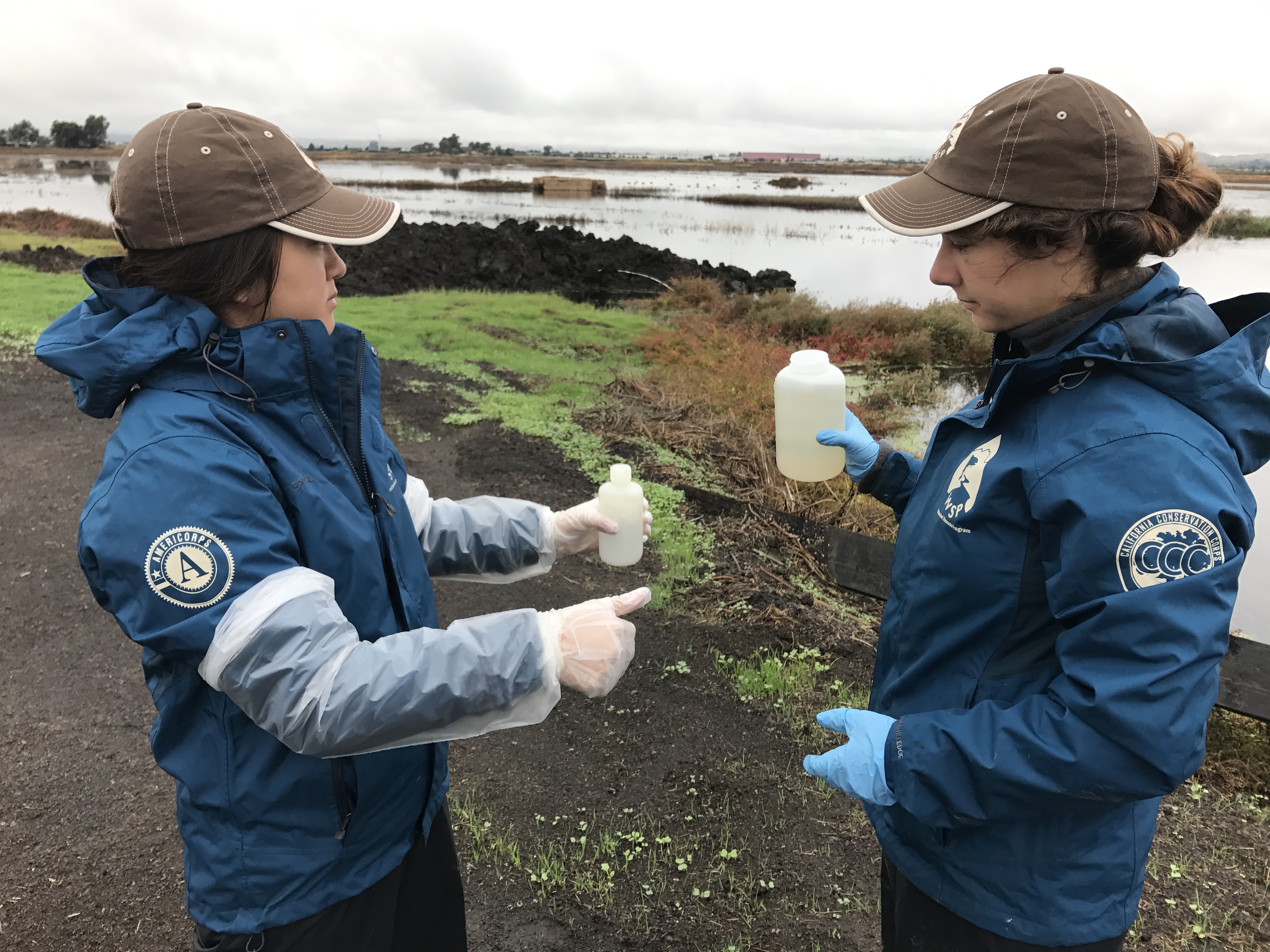
The Napa River Pathogens Total Maximum Daily Load (TMDL) Implementation plan includes water quality monitoring every five years to assess progress made toward attaining TMDL targets. Watershed Stewards Program Corps members and Scientists from the SF Bay Regional Water Quality Control Board created this map to show results from monitoring in 2022. This map will be updated in the future to show additional monitoring results. More information on this TMDL can be found on the Napa River Pathogen TMDL webpage.
NEW - Community Outreach and Water Quality in Historically Underserved Communities
SF Bay Regional Water Quality Control Board staff and community partners monitored summer levels of illness-causing bacteria at publicly accessible creeks in historically underserved communities throughout the East Bay. The data were assessed using the U.S. EPA objective for water recreation and published in online data maps. Staff coordinated with local land managers to alert the public of potentially unsafe conditions. Multilingual advisory signs with QR codes linking to the online maps were posted at creeks of concern.
- East Bay E. Coli Monitoring Map(ca.gov)
- SWAMP Environmental Justice and Community Outreach Report (2022-23)
NEW - TMDL/Pathogen Maps for Richardson Bay and Tomales Bay
The San Francisco Bay Regional Water Quality Control Board has created maps of long-term bacteria monitoring in and around Tomales Bay and Richardson Bay. Watershed Stewards Program Corpsmembers and Scientists from the SF Bay Regional Water Quality Control Board created this map to represent bacteria loads from pre-TMDL sampling, post-TMDL sampling, and the present. More information on each of these TMDLs can be found on the Region 2 TMDL webpage.
NEW -An assessment of the biological condition of streams in the San Francisco Bay Area
The authors of this report assessed over 20 years of bioassessment data relative to stressor gradients in the San Francisco Bay Area and concluded alternative thresholds may be more appropriate to assess intermittent streams and modified channel types.
North Bay Fires in 2017
In October 2017, three large wildfires burned over 100,000 acres in the North Bay. Fires can cause significant increases in contaminants including nutrients (e.g. nitrates and phosphorus), polycyclic aromatic hydrocarbons (PAHs), copper, zinc, mercury, lead, and other metals, so we monitored for those pollutants in Napa River and Sonoma Creek watersheds. Results indicate water quality was not impacted by fires in either watershed.
- Sonoma Creek Fact Sheet
- Napa River Fact Sheet
- Sampling Design and Analyte List
- Data Summary (in Excel)
- Interactive Mapping Feature
For more information, please contact Rebecca Nordenholt at RNordenholt@waterboards.ca.gov or (510) 622-1013.
Assessment of Select Estuaries of Marin County
The authors of this report prepared report cards on bar-built estuaries (BBE) at: Horseshoe Pond, Drakes Beach, Redwood Creek, Rodeo Valley, and Tennessee Valley. Marin County BBE Report Cards are available for download from the Central Coast Wetlands Group Document Library.
Mussel Watch Program/Toxic Substances Monitoring
For 27 years (1976-2003) fish, mussels and clams, and other aquatic life forms were collected from California's fresh, estuarine, and marine waters. Samples were analyzed for trace elements, pesticides, and PCBs. This provided the State Water Resources Control Board with a uniform statewide approach to the detection and evaluation of the occurrence of toxic substances. This monitoring primarily targeted areas with known or suspected impaired water quality. Information collected through these efforts are still used by the State and Regional Water Boards, and other agencies to identify waters impacted by toxic pollutants.
Bay Protection and Toxic Cleanup Program (BPTCP)
The BPTCP began in 1990 and ended in 1999. The program had four major goals: (1) protect existing and future beneficial uses of bay and estuarine waters; (2) identify and characterize toxic hot spots; (3) plan for the prevention and control of further pollution at toxic hot spots; and (4) develop plans for remedial actions of existing toxic hot spots and prevent the creation of new toxic hot spots.
Water Quality and Total Maximum Daily Load (TMDL) Report Cards
- Castro Cove – Sediment Remediation
- Fitzgerald Marine Reserve – Bacteria
- Guadalupe River – Mercury
- Lagunitas Creek – Nutrients
- Napa River – Bacteria
- Napa River – Nutrients
- Napa River – Sediment
- Pacific Ocean at Muir Beach – Bacteria
- Richardson Bay – Bacteria
- San Francisco Bay – Mercury
- San Francisco Bay – PCBs
- San Francisco Bay Urban Creeks – Pesticide Toxicity
- Sonoma Creek – Bacteria
- Sonoma Creek – Nutrients
- Suisun Marsh – Low Dissolved Oxygen
- Tomales Bay – Mercury
- Tomales Bay Tributaries – Bacteria
- Walker Creek – Mercury
- Walker Creek – Nutrients
Regional Monitoring Program (RMP) for Water Quality in the San Francisco Estuary
The RMP is an innovative partnership between regulators, dischargers, industry representatives, community activists and scientists to measure water quality in the San Francisco Estuary. The program is designed around management questions important to the Regional Water Board for regulating water quality in the estuary. The San Francisco Estuary Institute manages the program and conducts many of the studies. The RMP includes a status and trends component that measures water and sediment chemistry and toxicity, contaminant levels in fish and bird eggs, and loading of chemicals of concern to the estuary. There are also pilot and special studies that address sources and loadings, fate and transport and effects of pollutants. For more information, please visit the RMP homepage.Under the Bay Area Stormwater Management Agencies Association (BASMAA), the Phase I Municipal Stormwater permittees (Alameda, Contra Costa, San Mateo and Santa Clara Counties and the Cities of Fairfield, Suisun and Vallejo) work together as the Regional Monitoring Coalition to collect receiving water quality data. Types of data collected include general water quality, toxicity, and concentrations of pollutants of concern, such as copper, mercury, PCBs, and others. All monitoring requirements are spelled out in Provision C.8 of the Municipal Regional Permit.
Subsequent to BASMAA's dissolution in 2021, the Bay Area Municipal Stormwater Collaborative (BAMSC) was organized by the BASMAA Board of Directors to continue BASMAA's information sharing and Permittee advocacy functions in an informal manner. More information can be found on the BASMAA website.
Monitoring Reports available upon request:
Stormwater Monitoring Reports (2012-current)
- Alameda Countywide Program
- Contra Costa Countywide Program
- San Mateo Countywide Program
- Santa Clara Valley Urban Runoff Pollution Prevention Program
- Fairfield-Suisun and Vallejo Program
PCB, Mercury, and other Pollutants of Concern Monitoring (2012-current)
- Alameda Countywide Program
- Contra Costa Countywide Program
- San Mateo Countywide Program
- Santa Clara Valley Urban Runoff Pollution Prevention Program
Stormwater Monitoring Sampling Procedures and Quality Assurance Documents (2016-current)
Statewide Groundwater Ambient Monitoring & Assessment Program (GAMA)
GAMA is a statewide program that monitors regionally and also undertakes special studies. The main objectives of the program are to improve statewide ambient groundwater quality monitoring and assessment and increase the availability of information about groundwater quality to the public. Participation in the GAMA Program is voluntary; stewardship of the state's groundwater resources is the shared responsibility of all levels of the government and community. GAMA has produced numerous reports and other products on groundwater quality investigations throughout California. To learn more about groundwater monitoring and assessment, please visit the GAMA homepage.Contact
Environmental Scientist
Phone: (510) 622-2334
Email: Kristina.Yoshida@waterboards.ca.gov
