![[Add Program Name Here] Program Logo](/sanfranciscobay/images/banner/dredging_reuse.jpg)
Beneficial Reuse and Sea Level Rise Adaption
Beneficial reuse of dredged material is an integral and necessary part of the dredged material management process, especially in light of the 1.0 to 2.4 feet of sea level rise expected in San Francisco Bay by 2100 (Water Board 2019). Dredged material can be beneficially used in upland, wetland, and aquatic environments. More details, plus a map showing the locations of active and soon-to-be active beneficial reuse sites around the Bay, are available here.
San Francisco Estuary Institute (SFEI) maintains a database called Sedimatch to help the dredging community connect with projects in need of clean sediment. Guidelines for physical, chemical, and biological sediment testing and evaluation of test results for placement of dredged materials in beneficial reuse environments are available in this document.
Port of Oakland Harbor Navigation Improvement Project and Beneficial Reuse
January 2010 marked the completion of the delivery and beneficial reuse of dredged material from deepening the Oakland Harbor, a 10-year process conducted under a series of permits issued by the Water Board. Beginning in 2002, over 12 million cubic yards of sediment was dredged to accommodate new classes of container ships. Permits issued by the Water Board protected human health, habitat, and water quality during both the dredging and the subsequent relocation of the dredged material. Nearly all of the dredged material from the Oakland Harbor has been reused for wetland restoration, habitat enhancement, and construction projects in and around the San Francisco Bay.
One of the first areas in the San Francisco Bay region to realize the benefits of reusing dredged material from the Oakland Harbor was Middle Harbor Shoreline Park, adjacent to the Port of Oakland. Approximately 5.8 million cubic yards of dredged material is being used to restore about 188 acres of shallow water habitat, such as eelgrass beds, and to provide recreational access to the Bay at a location previously cut off from such access.
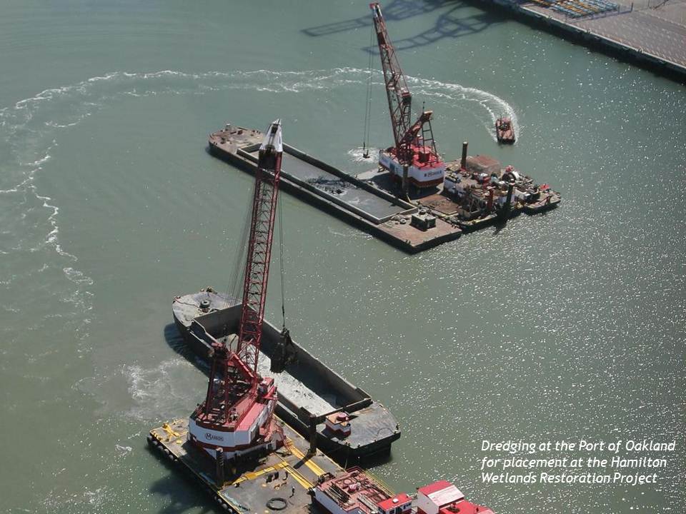
Hamilton Wetlands Restoration Project
This project is a joint effort of the Army Corps of Engineers and the State Coastal Conservancy that is restoring approximately 640 acres of tidal wetlands, seasonal wetlands, transitional zones, and upland habitats. The restored wetlands were formerly runways and grassland areas at the former Hamilton Army Airfield in Novato. Hamilton/Bel Marin Keys Wetlands Restoration website.
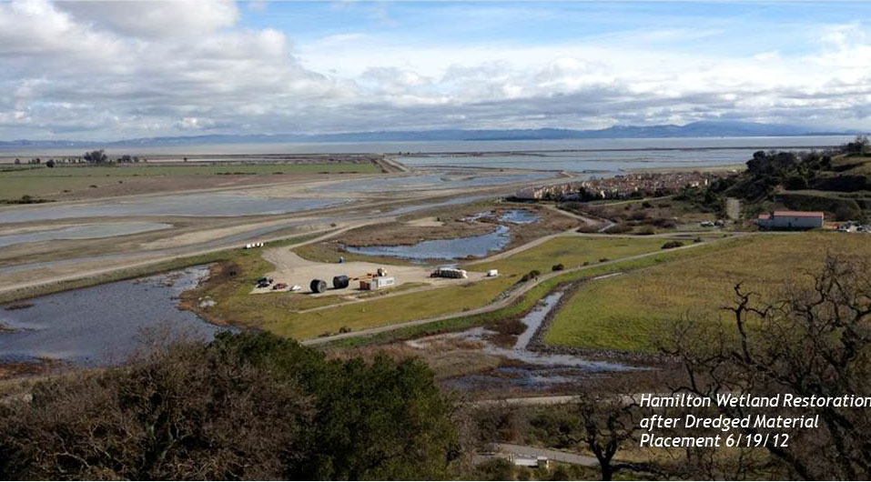
Approximately 6 million cubic yards of sediment have been placed at the site (see photos above) to create and restore the proper elevations for tidal and seasonal wetlands. This project is similar to a few other projects in the Bay that have demonstrated beneficial reuse of dredged sediments, for example, Sonoma Baylands. This project is a major contribution to the restoration of priority habitats for San Pablo Bay. After many years of remediation and restoration work, the wetlands were opened to tidal action on April 25, 2015. The restored wetland will provide ecological benefits for several endangered and other target species such as California clapper rail, Chinook salmon, steelhead, salt marsh harvest mouse, shorebirds and others. The Army Corps will conduct monitoring and adaptive management at the site for 13 years post-breach in order to ensure that the restoration goals are met. After this period, the State Coastal Conservancy will continue to monitor the development of the wetlands and maintain the site.
Montezuma Wetlands Restoration Project
This privately owned and operated project located at the eastern edge of the Suisun Marsh will restore nearly 2,000 acres of tidal and seasonal wetlands on historical tidal marsh land that was diked and drained for agricultural use more than 100 years ago. Since opening in December 2003 and through 2019, Montezuma has received approximately 8 million cubic yards of dredged material out of a total of 17.5 million cubic yards available. A substantial portion of dredged sediment, 3 million cubic yards, came from the Oakland Harbor Deepening Project. This project is unique because some of its dredged material placement cells are designed and constructed to contain sediment that is slightly more chemically challenged than the cleanest Bay sediment that is typically used in tidal marsh restoration projects. This type of sediment is called “foundation” or “noncover” material to differentiate it from “surface” or “cover” material. Up to 20% of the dredged material delivered to the project may be foundation material. The Water Board’s permit requires that foundation material must be covered by, at a minimum, three feet of surface/cover quality sediment and be isolated surface-water bodies and constructed channels by at least 200 lateral feet of surface sediment. Acceptance of foundation material allows beneficial reuse of sediment that would otherwise be permanently lost from the Bay system via disposal at the ocean disposal site or upland sites.
The Water Boards are working toward innovative storm water quality solutions including incorporation of low impact development objectives, green chemistry pollutant control, and education outreach through films.
-
Impaired Waterbody and Total Maximum Daily Load Map Tool
- Impaired Waterbody Map Features:
- This map tool allows a user to locate Hydrologic Unit Code 10 (HUC-10) watersheds and impaired waterbodies with applicable requirements from Appendix 3 of the Industrial General Permit.
- Total Maximum Daily Load Map Features:
- This map tool allows a user to find Total Maximum Daily Load (TMDL) waterbody(ies) or watersheds that will have implementation requirements through the Industrial General Permit effective July 1, 2020.
- DISCLAIMER: The map tool is for information only and there is no explicit or implied assurance of the accuracy for the information provided. The map tool will help Dischargers determine potentially applicable TMDL requirements based upon facility location, but it is ultimately the responsibility of the Discharger to identify applicable TMDL requirements by identifying the facility’s: 1) receiving waterbody(ies), 2) the pollutants discharged, and 3) applicable requirements in Attachment E of the Industrial General Permit.
- Impaired Waterbody Map Features:
Region 2 Contact
Jazzy Graham-Davis
Jazzy.Graham-Davis@waterboards.ca.gov
Phone: (510) 622-2509
