SWAMP - San Joaquin River Basin
Quick Links
Basin Overview
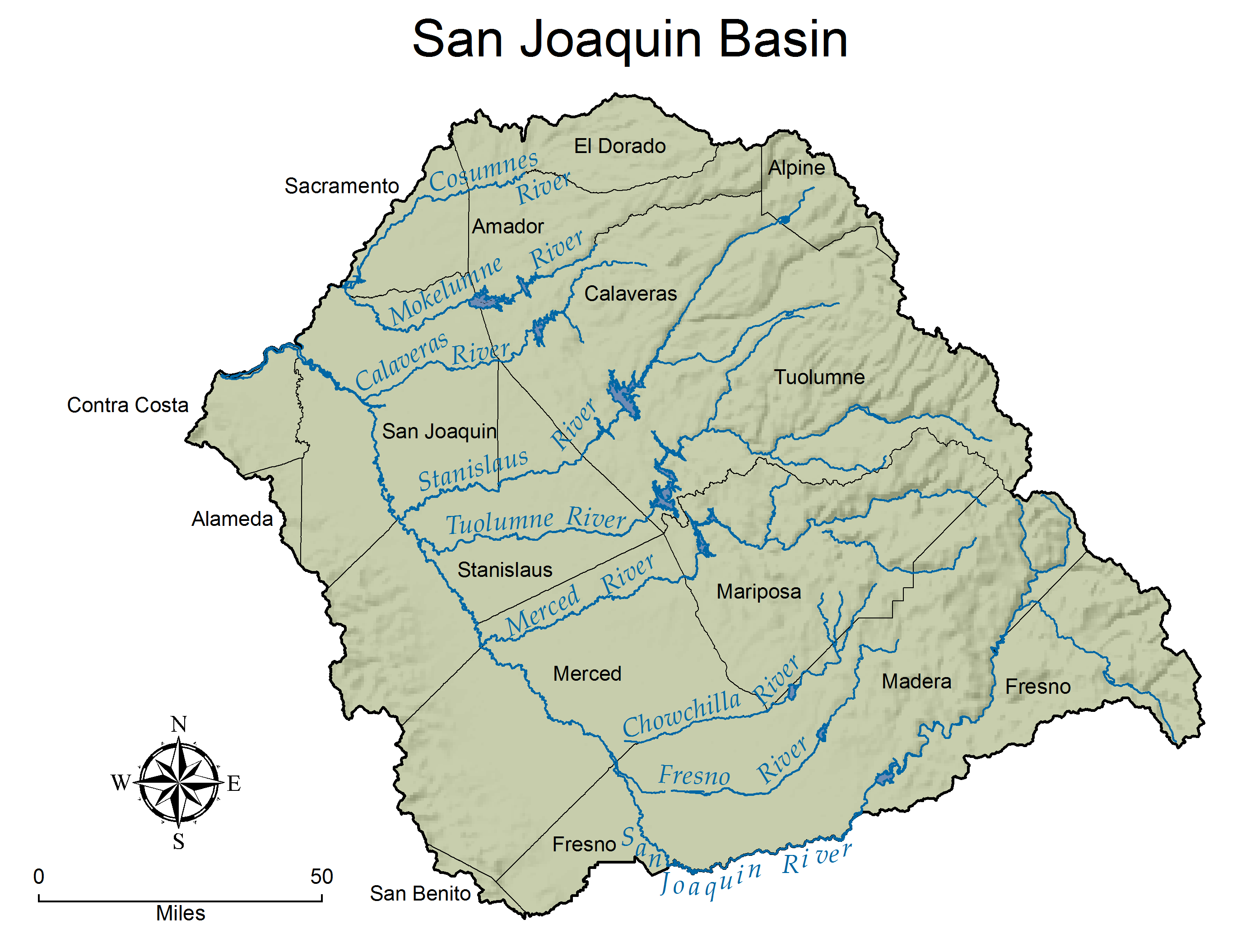
The San Joaquin River (SJR) flows northward and drains the portion of the Central Valley south of the Sacramento-San Joaquin Delta and north of the Tulare Lake Basin. The basin covers 15,880 square miles and yields an average annual surface runoff of about 1.6 million-acre feet. The lower Basin (below Millerton Lake Reservoir) has had a highly managed hydrology since the implementation of the Central Valley Project (CVP) in 1951. Most of the SJR flow is diverted into the Friant-Kern Canal, leaving the river channel upstream of the Mendota Pool dry except during periods of wet weather flow and major snow melt. Flows from the west side of the river basin are dominated by agricultural return flows since west side streams are ephemeral and their downstream channels are used to transport agricultural return flows to the main river channel. Poorer quality (higher salinity) water is imported from the Delta for irrigation along the west side of the river to replace water lost through diversion of the upper SJR flows. The principal streams in the basin are the San Joaquin River and its larger tributaries: the Cosumnes, Mokelumne, Calaveras, Stanislaus, Tuolumne, Merced, Chowchilla, and Fresno Rivers which all drain the east side of the basin. Major reservoirs and lakes include Camanche, Pardee, New Hogan, Millerton, McClure, Don Pedro, and New Melones. Major land use along the San Joaquin Valley floor is agricultural, with over 2.1 million irrigated acres, representing 22% of the irrigated acreage in California. Urban growth is rapidly converting historical agricultural lands leading to an increased potential for storm water and urban impacts to local waterways. Upper watershed areas can be impacted by timber activities, grazing, abandoned mines, rural communities, and recreation.
Grassland Bypass Project
Grassland Bypass Project Data collected from October 1995 through December 2016 by the Central Valley Regional Water Quality Control Board is available in CEDEN (California Environmental Data Exchange Network).
Main-stem San Joaquin River
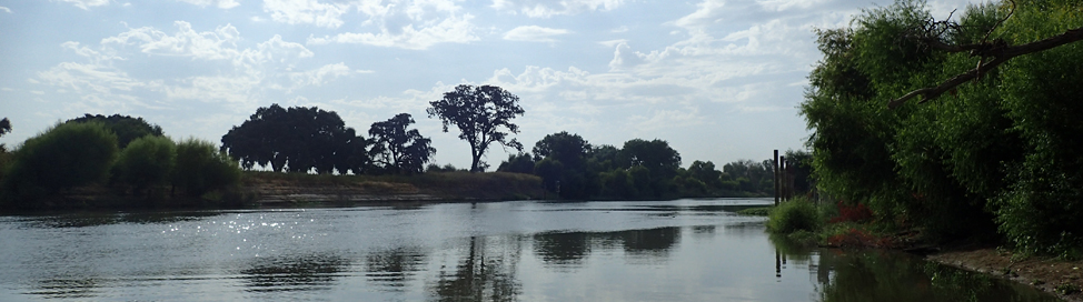
The San Joaquin River serves as the drainage channel for the entire 16,000 square mile basin and discharges into the Sacramento-San Joaquin Delta. Currently the river is monitored by various state agencies for several projects along the San Joaquin River, including the Grasslands Bypass Project (in effect since 1996) and more recently the San Joaquin River Restoration Project (in effect since 2008). The Central Valley Regional Water Quality Control Board coordinates with other state and federal agencies in addition to several stakeholder groups to ensure the monitoring of water quality. To see current monitoring programs on the San Joaquin River please visit the Central Valley Monitoring Directory. Data is available on CEDEN.
Representative Drainage Basin Inflows
Based on evaluations conducted during the Inland Surface Water Plan (1992) and initial TMDL evaluations, six sub-watersheds have been identified in the San Joaquin River Basin:
- Northeast Basin: Comprised of the Cosumnes, Mokelumne, and Calaveras Watersheds as well as eastside areas draining into the Sacramento-San Joaquin Delta downstream of Vernalis.
- Eastside Basin: Comprised of the Stanislaus, Tuolumne, and Merced Watersheds as well as eastside valley floor areas draining directly to the main stem of the San Joaquin River.
- Southeast Basin: Eastside areas draining into the San Joaquin River upstream of the San Joaquin River at Lander Avenue (Hwy 165).
- Grassland Basin: Westside drainage into the San Joaquin River upstream of the Orestimba Creek watershed. Encompasses the Grassland Watershed (specifically identified within the Basin Plan which in turn encompasses the Drainage Project Area (97,000-acres of intensively farmed land that discharges selenium enriched subsurface agricultural drainage).
- Northwest Basin: Westside drainage into the San Joaquin River between the Grassland Basin and the Sacramento-San Joaquin Delta.
- Delta Basin: Westside drainage into and including the Lower Sacramento and Lower San Joaquin River systems.
Each sub-area is bounded by either the Sierra Nevada or Coast Range and is comprised of like land uses and drainage patterns. All natural and constructed water bodies have been identified in each sub-area as well as potential water quality concerns and major representative discharges to the lower river. Multi-constituent monitoring is to be conducted at these representative discharges from each basin on monthly basis and twice a month during the irrigation season (February through August). The monitoring will allow an evaluation of the potential water quality concerns within the drainage basins as well as the relative impacts from the basins on the lower river.
Intensive Rotational Basin Program
Six sub-basins have been identified in the San Joaquin River Basin. Once every five years, expanded monitoring "rotates" into one of the sub-watersheds. During this rotation, sampling sites are selected based on land use in subareas and local stakeholder input, and then monitored twice a month for 1-year. Constituents selection is based on: historic information; data gathered as part of the Drainage Basin Inflows component; stakeholder response to a monitoring survey; and available funding. At a minimum, each site is analyzed for standard field measurements (electrical conductivity, pH, temperature, turbidity, and dissolved oxygen) as well as total Coliform and E. coli. information on these six sub-basins can be found on the Intensive Rotational Basin Program description site.
SJR-SWAMP: 2000-2005
During the first five years, SWAMP efforts for the SJR built upon a site-specific monitoring framework developed as part of the agricultural subsurface drainage management program that has evolved since 1985.
The monitoring objectives of SJR SWAMP were:
- to evaluate whether the most limiting beneficial uses in a specific water body were being protected, to help identify sources of potential impairment, and
- to determine, over time, if implementation efforts are improving water quality.
The most limiting beneficial uses were identified as Drinking Water, Aquatic Life, Irrigation Water Supply, Recreation, and Waterfowl. Parameters selected to evaluate each beneficial use were as follows
- Drinking Water: salt, bacteria, Total Organic Carbon (TOC)
- Aquatic Life: trace elements, toxicity, bioassessment
- Irrigation Water Supply: salt, boron, minerals
- Recreation: bacteria
- Waterfowl: selenium
To identify potential sources of impairment, a layered monitoring framework was developed
- Long-term monitoring sites along the main stem of the SJR downstream of major inflows.
- Long-term monitoring sites representing inflows from specific sub-watersheds into the main stem of the river.
- More detailed monitoring of water quality within each of the sub-watersheds on a rotational basis.
The long-term monitoring sites allowed for evaluations of water quality over time and over water year types. The Intensive Rotational Basin Program allowed for more detailed monitoring in each sub-basin based on land use, historic data, and stakeholder input. Rotations were completed in the Northeast Basin (2002-2003), Eastside Basin (2003-2004), and Westside Basin (2004-2005).
- For assessment reports, please visit our SWAMP Water Quality Reports page.
Fresno River Nutrient Monitoring
A special study was conducted on the Fresno River in 2001 and 2002. Nutrients from the Fresno River were identified as a possible contributor to algal blooms observed in Hensley Lake. The County of Madera Engineering Department was awarded a 205(j) grant to collect water quality data, develop a nutrient loading model, and develop a plan to reduce nutrients. To begin to obtain data prior to the execution of the grant contract, the Fresno office used SWAMP funds to begin baseline sampling and gather preliminary data from the Fresno River and Hensley Lake. Four sampling events were conducted in the watershed between August 2001 and June 2002.
- Report: Fresno River Annual Report: Fiscal Year 2001-2002
San Joaquin River Basin Map