
Maps and Data
SAFER Dashboard
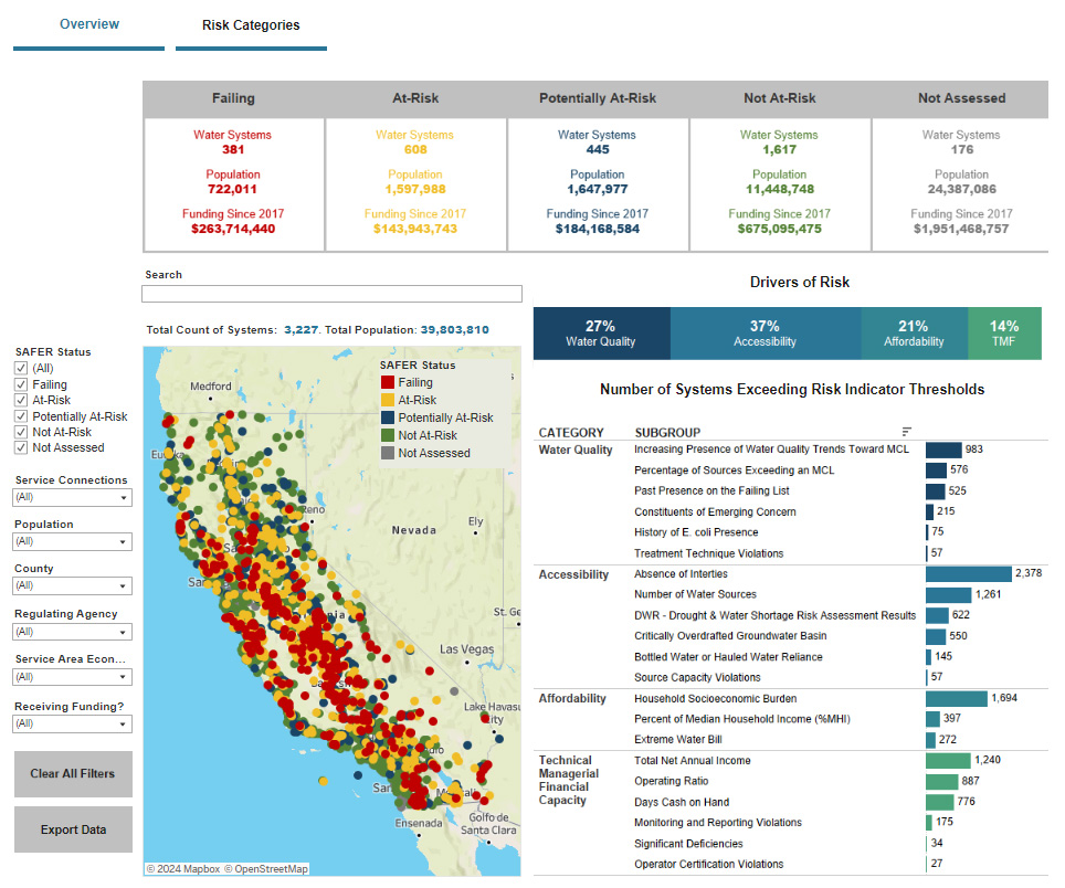
This map illustrates the current Failing: Human Right to Water systems and the results of the Risk Assessment for California community water systems with up to 30,000 service connections or 100,000 population served and K-12 schools. The Risk Assessment is a component of the Drinking Water Needs Assessment. Users can search or filter this information by public water system ID, system name, county, regulating agency, system size, etc. The data used to identify At-Risk systems is available in the 2022 Risk Assessment Results Spreadsheet.
The list of failing systems is updated daily.
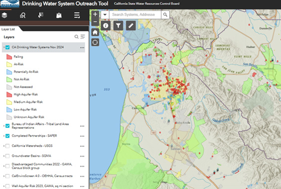
Public Water System Outreach Tool
A map-based tool for California water system professionals and members of the public. Public water systems and state small water system locations are aggregated as one layer for use with various analysis tools. Several other contextual layers are available for analysis, including, tribal land areas; previously completed drinking water partnerships and consolidations; watersheds; basins; disadvantaged community status; CalEnviroScreen health hazard scores; well aquifer risk, California counties, and crop mapping. Additional layers may be available upon request.
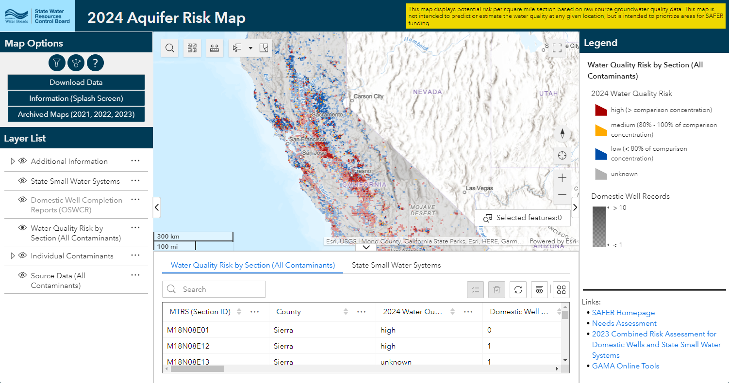
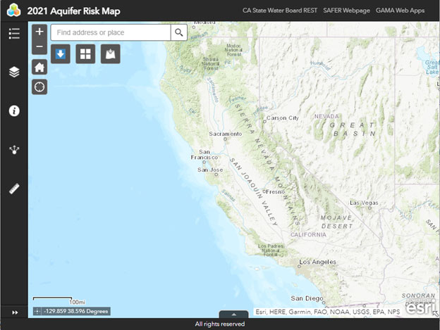
Aquifer Risk Map
This Aquifer Risk Map is developed to fulfill requirements of SB-200 and is intended to help prioritize areas where domestic wells and state small water systems may be accessing groundwater that does not meet primary drinking water standards. In accordance with SB-200, the risk map is to be made available to the public and is to be updated annually starting January 1, 2021. The Fund Expenditure Plan states the risk map will be used by the Water Boards staff to help prioritize areas for available SAFER funding. This is the final 2021 map based upon feedback received from a draft map published in October 2020.
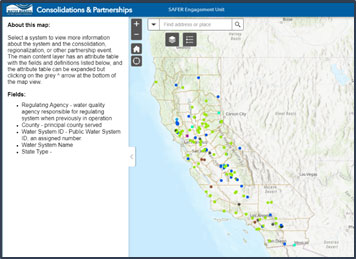
Water System Partnership
This Water System Partnership Map can be used to explore completed consolidations and other water partnerships as tracked by the SAFER Engagement Units. The SAFER Engagement Units are a team of engineers and program specialists within the Division of Drinking Water. Their mission is to support water systems in achieving long-term sustainability. They organize water quality and quantity improvement projects for water systems currently on, or at risk of Failing HR2W criteria. SAFER promotes community participation, facilitates funding discussions, coordinates water system Administrator appointments, and advances sustainable alternatives such as water partnerships.
