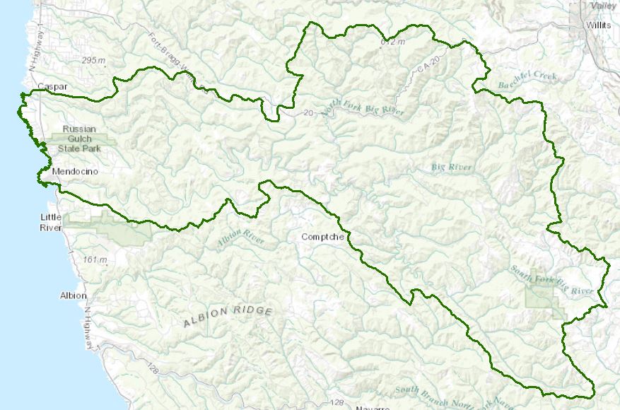
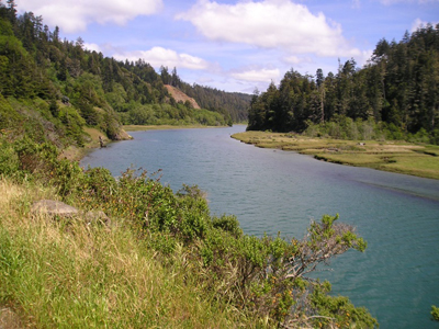
Big River Watershed - Hydrologic Unit 113.30
Water Quality, Flow, and Water Rights
2012 Water Quality Assessment Report
Every six years the North Coast Water Board evaluates water quality information and identifies water bodies that do not meet water quality standards and are not supporting their beneficial uses. Those waters are placed on a list of impaired water bodies that identifies the pollutant or stressor causing impairment and establishes a schedule for developing a control plan to address the impairment.
Impaired Water Bodies in the Big River Hydrologic Area |
||
Water Body Name |
Listing Extent |
Pollutant |
|
|
Temperature |
Big River Beach at Mendocino Bay |
Entire water body |
Indicator Bacteria |
Big River HA, Berry Gulch |
Little North Fork |
Temperature |
Rocky Gulch, the Little North Fork, and Manley Gulch |
Oxygen, Dissolved |
|
Big River HA, Big River |
Cookhouse Gulch, Railroad Gulch, and the mainstem Big River |
Oxygen, Dissolved |
Entire water body |
Sedimentation/Siltation Temperature |
|
Main program page:
Map of water quality listed segments. (Click on the map tab)
2008 North Coast Water Board's Sediment TMDL Implementation Workplan
The Regional Water Board adopted a TMDL implementation policy statement in 2004 and a subsequent Workplan in 2008 that details efforts to address sediment impaired water bodies in the region. The section on the Big River begins on page 43.
2001 Big River TMDL for Sediment
Water Rights Database
Statements of water diversion and use, registrations, certificates and water rights permits are accessible on the eWRIMS, Electronic Water Rights Information Management System. This link includes a mapping application.
California Environmental Data Exchange Network
Water quality and habitat data and information are contained at this site in a spreadsheet format. Pay careful attention to the instructions.
Landscape Information
2005 N. Coast Water Board Watershed Initiative Chapter, Russian/Bodega WMA
The North Coast Region developed a Watershed Initiative Chapter as part of the State Water Board's Watershed Management Initiative that provides an overview of that watershed, a description of its water quality concerns and issues, past significant Regional Board activities in the watershed, activities as of 2005, near-term activities that would benefit the watershed, and activities which may happen on a longer time-scale.
California Geographic Information Portal
This portal has a search engine for the portal itself and ArcGIS online. Information and GIS layers can be accessed for a variety of data, including hillshade, vegetation, rivers, contours, stream fish habitat by reach, stream inventory reports, and CalWater 2.2 maps.
CalFire Fire and Resource Assessment Program
This site contains a wealth of information on the amount and extent of forest and rangelands along with analysis of conditions. Maps, projects, and assessments are available on the site, including GIS layers for timber harvesting, vegetation, and other resources.
U.S. Natural Resources Conservation Service Geospatial Data Gateway
Environmental and natural resources GIS files are available at this site, along with an interactive national map viewer.
Watershed Condition Information
KRIS Big
This system was originally developed as a data repository and analysis and management tool for the Klamath River watershed. A host of information is available through this site, including maps, water quality data, fisheries data, photographs, and scientific references.
North Coast Watershed Assessment Program
This multi-agency program began in 1999 and was defunded in 2002 due to state budget cuts. It was a five-agency effort to gather historical and current information on selected North Coast watersheds, assess the information, draw conclusions regarding trends and current watershed conditions, and provide recommendations for land use, restoration, and study in the future. Participating agencies included the Department of Fish and Wildlife (formerly Dept. of Fish and Game), CalFire (formerly California Department of Forestry), California Geological Survey (formerly Division of Mines and Geology), Department of Water Resources, and North Coast Regional Water Quality Control Board.
Reports from that effort are on a California Department of Fish and Wildlife website. The CDFW has continued to gather and assess information on North Coast watersheds since the statewide program was eliminated. The link to the CDFW website provides the assessment report and a small map of salmonid refugia ratings. CDs of the report and appendices, including ArcInfo shape files can be obtained by contacting the California Department of Fish and Wildlife, Wildlife and Habitat Data Analysis Branch, 1807 13th Street, Suite 202, Sacramento, CA 95814 (916) 324-9265.
California EcoAtlas
This website provides access to information on wetlands, including integration of some water quality information.
Watershed Groups, Partnerships, and Collaboration
The Conservation Fund
The Conservation Fund owns lands in the Usal Creek, Big River, Salmon Creek, Garcia River, and Gualala River watersheds.
Salmonid Restoration Federation
This nonprofit group was formed in 1986 to assist salmonid restoration efforts in California by promoting "restoration, stewardship, and recovery of California native salmon, steelhead and trout populations through education, collaboration, and advocacy." Their web site contains a wealth of information on salmonids and habitat and stream restoration in California.
UC Davis Information Center for the Environment, Natural Resource Project Inventory
This database provides information on natural resource projects in California, including links to data and information collected by the projects.
California Watershed Network
This nonprofit organization was formed in 2000 to help protect and restore watersheds in California through community-based networks. The website contains some information on watershed events and older information on watersheds of interest, but most of it has not been updated since 2011.
Fisheries and Wildlife Information
CA Dept Fish and Wildlife Stream Inventory Reports
This California DFW site allows searches by major watershed areas (advanced search on subcategory=Mendocino Coast and "Big River").
CalFish Cooperative Anadromous Fish and Habitat Data Program
This cooperative agency site provides information on anadromous fish habitat and populations in an interactive environment. The site has numerous links to information libraries and systems in California.
National Oceanic and Atmospheric Administration
NOAA Fisheries is responsible for listing and recovery efforts for anadromous fishes. The 2012 Recovery Plan for coho salmon in the North Central California Coast ESU contains information on the habitat, population status, stressors and threats, recovery efforts, and recovery strategy. This web page also contains a link to the 2007 steelhead trout recovery strategy.
The links and information on this page are provided in an attempt to make a broad range of information available on a watershed basis. While the Water Board has been involved in work within watersheds with a variety of agencies and watershed groups, we cannot vouch for the currency or accuracy of information contained within the internet links we have included. We suggest that you check with the original sources if there is any question regarding currency, accuracy, or origin of information.
Created February 4, 2105; updated February 3, 2016
Web page contact: Robert Klamt, rklamt@waterboards.ca.gov
(Page last updated 10/16/17)
Water is a precious resource in California, and maintaining its quality is of utmost importance to safeguard the health of the public and the environment.
Statewide Campaigns
EPA Water Sense
File an Environmental Complaint
Save Our Water
Flex Alert
Register to Vote
