Gualala River Watershed - Hydrologic Area 113.80
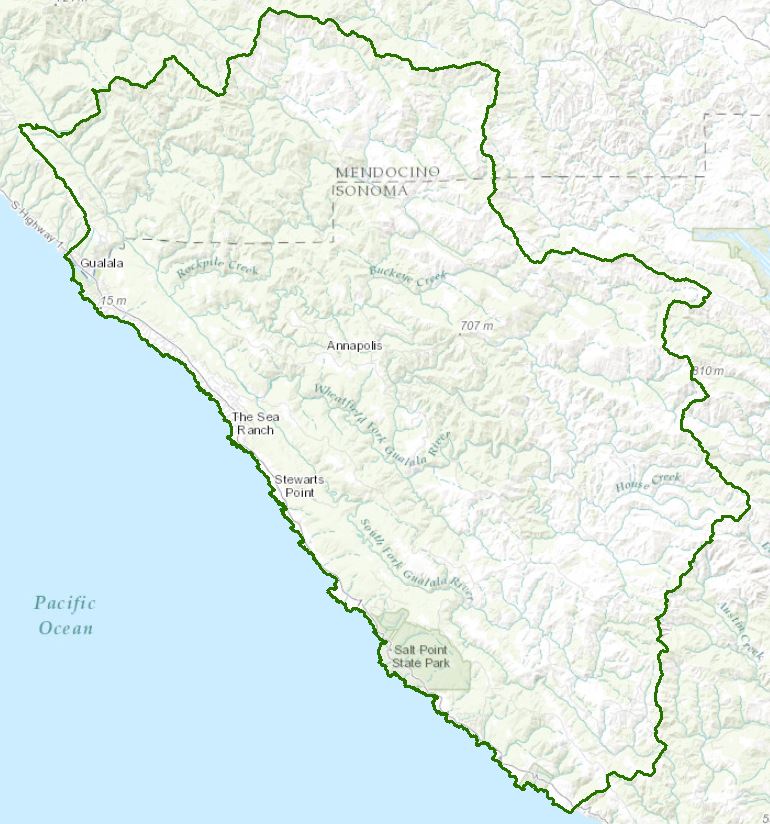
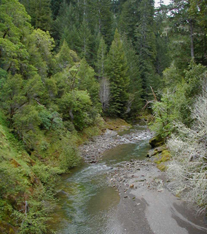
This coastal watershed is located in southern Mendocino and Northern Sonoma counties about 100 miles north of San Francisco. The 298 square mile watershed is characterized by rugged mountainous terrain with erodible soils forested by redwood, Douglas fir, madrone, and tan oak. It is an important steelhead stream and once supported a coho salmon population. A TMDL for sedimentation was developed in 2001.
The Gualala River watershed was the subject of a multi-agency watershed assessment program under the North Coast Watershed Assessment Program from 1999 through 2002, which provided substantial information on the historical and current geography, geology, water resources and water quality, wildlife and fisheries resources, forest resources, and geology of the watershed. Substantial data collection and watershed restoration efforts have been undertaken, and are continuing, in the watershed through the efforts of private and industrial landowners and local, state, and federal agencies.
Water Quality, Flow, and Water Rights
2012 Water Quality Assessment Report
Every six years the North Coast Water Board evaluates water quality information and identifies water bodies that do not meet water quality standards and are not supporting their beneficial uses. Those waters are placed on a list of impaired water bodies that identifies the pollutant or stressor causing impairment and establishes a schedule for developing a control plan to address the impairment.
Impaired Water Bodies in the Gualala River Hydrologic Area |
||
Water Body Name |
Listing Extent |
Pollutant |
Gualala River HA, |
Mainstem Gualala River |
Aluminum |
Entire water body |
Sedimentation/Siltation |
|
Entire water body except: the Little North Fork Gualala River and its tributaries |
Temperature |
|
Main program page:
Map of water quality listed segments. (Click on the map tab)
2008 North Coast Water Board's Sediment TMDL Implementation Workplan
The Regional Water Board adopted a TMDL implementation policy statement in 2004 and a subsequent Workplan in 2008 that details efforts to address sediment impaired water bodies in the region. The section on the Gualala River begins on page 123.
Gualala River Estuary Studies
The Water Board conducted basic water quality assessment in the Gualala River estuary in 2003. Data, graphs, and analysis are available in this report.
2001 TMDL and Technical Support Document for Sediment
The North Coast Water Board staff prepared a technical support document describing sources of sediment, loading capacities, and impairments, and developed load allocations necessary to restore conditions and support beneficial uses related to the cold water fishery in the Gualala River. The technical support document and consequent TMDL promulgated by USEPA, including hillslope and instream targets are available on the website.
2013 TMDL report Card
This is a one-page summary of some of the accomplishments in the watershed in relation to the TMDL, especially highlighting the efforts of the Gualala River Watershed Council and individual landowners.
California Environmental Data Exchange Network
This site, maintained by the State Water Resources Control Board, contains water quality and habitat information in a spreadsheet format. IPay careful attention to the instructions.
U.S. Geological Survey, Stream Flow Data
N. Fork Gualala River above the S. Fork (station 11467553)
S. Fork Gualala River near the Sea Ranch (station 11467510)
Water Rights Database
Statements of water diversion and use, registrations, certificates and water rights permits are accessible on the eWRIMS, electronic Water Rights Information Management System. This link includes a mapping application.
Landscape Information
2005 N. Coast Water Board Watershed Initiative Chapter, Gualala River
As part of the State Water Board's Watershed Management Initiative, the North Coast Region developed a Watershed Initiative Chapter that provides an overview of that watershed, a description of its water quality concerns and issues, past significant Regional Board activities in the watershed, activities as of 2005, near-term activities that would benefit the watershed, and activities which may happen on a longer time-scale.
California Geographic Information Portal
This portal has a search engine for the portal itself and ArcGIS online. Information and GIS layers can be accessed for a variety of data, including hillshade, vegetation, rivers, contours, stream fish habitat by reach, stream inventory reports, and CalWater 2.2 maps.
CalFire Fire and Resource Assessment Program
This site contains a wealth of information on the amount and extent of forest and rangelands along with analysis of conditions. Maps, projects, and assessments are available on the site, including GIS layers for timber harvesting, vegetation, and other resources.
U.S. Natural Resources Conservation Service Geospatial Data Gateway
Environmental and natural resources GIS files are available at this site, along with an interactive national map viewer.
Watershed Condition Information
North Coast Watershed Assessment Program
This multi-agency program began in 1999 and was defunded in 2002 due to state budget cuts. It was a five-agency effort to gather historical and current information on selected North Coast watersheds, assess the information, draw conclusions regarding trends and current watershed conditions, and provide recommendations for land use, restoration, and study in the future. Particpating agencies included the Department of Fish and Wildlife (formerly Dept. of Fish and Game), CalFire (formerly California Department of Forestry, California Geological Survey (formerly Division of Mines and Geology), Department of Water Resources, and North Coast Regional Water Quality Control Board.
Reports from that effort are on a California Department of Fish and Wildlife website. The CDFW has continued to gather and assess information on North Coast watersheds since the statewide program was eliminated. The link to the CDFW website provides the assessment report and a small map of salmonid refugia ratings. CDs of the report and appendices, including ArcInfo shape files can be obtained by contacting the California Department of Fish and Wildlife, Wildlife and Habitat Data Analysis Branch, 1807 13th Street, Suite 202,
Sacramento, CA 95814 (916) 324-9265.
KRIS Gualala
This site presents watershed information by topic (e.g., climate, fisheries) and sub-watershed along with hypotheses regarding watershed conditions and the background information supporting a hypothesis. An extensive bibliography and some historical logging photos are available as well.
The Conservation Fund
The Conservation Fund owns 44,000 acres of forest in the Gualala River watershed.
Gualala Forest
Buckeye Forest
Mendocino Coast Model Railroad and Historical Society
A brief history of the town of Gualala is provided with some links to interesting information.
http://www.mendorailhistory.org/1_towns/towns/gualala.htmWatershed Groups, Partnerships, and Collaboration
Gualala River Watershed Council
A local coalition of interested parties, including state and federal agencies, gathered in the 1980s in response to the listing of the watershed on the Clean Water Act section 303(d) list as impaired from sedimentation. That coalition was formalized into the Gualala River Watershed Council (GRWC) in 1996, and continues to be a leader in data collection, assessment, and watershed restoration. The GRWC's comprehensive web site provides monitoring information and trend analysis, restoration information, and watershed mapping tools for landowners.
Friends of the Gualala River
This local group of residents was formed in 1992 in response to timber harvesting issues and has expanded to interest in the welfare of the river, watershed, and habitat.
Fish Friendly Farming
This certification program, now overseen by the California Land Stewardship Institute, began as a USEPA-funded project in the Russian River watershed to help farmers assess, plan, and conduct their operations in a manner that was "fish friendly." Farmers enroll in the program and are assisted in the assessment of their land and operations, and the development of a farm conservation plan. Final certification of the plan occurs through a third-party review by the County Agricultural Commissioner, the NOAA-Fisheries agency, and the Regional Water Quality Control Board. Historical information on the Gualala River watershed is provided with descriptions of lands that have been certified by the program.
Sonoma Resource Conservation District
The Sonoma RCD has been involved in Gualala River assessment and restoration efforts since the mid-1990s. While the RCD currently does not have funding for projects in the Gualala River watershed, information and links are provided for past projects.
North Coast Resource Partnership
This partnership began in 2004 as the North Coast Integrated Regional Water Management Plan, and is focused on watershed health, water quality, energy independence, adaptation to climate change, and economic vitality of the north coastal area. A number of funding programs are administered through this partnership. The website contains information on projects within this area; the following link takes you to that list:
UC Davis Information Center for the Environment, Natural Resource Project Inventory
This database provides information on natural resource projects in California, including links to data and information collected by the projects.
Salmonid Restoration Federation
This nonprofit group was formed in 1986 to assist salmonid restoration efforts in California by promoting "restoration, stewardship, and recovery of California native salmon, steelhead and trout populations through education, collaboration, and advocacy." Their web site contains a wealth of information on salmonids and habitat and stream restoration in California.
Fisheries and Wildlife Information
CA Dept Fish and Wildlife Stream Inventory Reports
This California DFW site allows searches by major watershed areas (advanced search on subcategory=Mendocino Coast and "Gualala River").
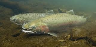
Gualala River Steelhead Studies
Local biologist, Richard DeHaven, presents information on the steelhead populations in the Gualala River watershed.
2002-2003 Physical and biological surveys of the lower Gualala River and estuary
Studies were contracted by the Sonoma RCD and the Gualala River Watershed Council for informing the development of an enhancement plan
National Oceanic and Atmospheric Administration, Fisheries, Recovery Planning guidance
NOAA Fisheries is responsible for listing and recovery efforts for anadromous fishes. The 2012 Recovery Plan for coho salmon in the North Central California Coast ESU contains information on the habitat, population status, stressors and threats, recovery efforts, and recovery strategy. This web page also contains a link to the 2007 steelhead trout recovery strategy.
CalFish Cooperative Anadromous Fish and Habitat Data Program
This cooperative agency site provides information on anadromous fish habitat and populations in an interactive environment. The site has numerous links to information libraries and systems in California.
Mendocino Redwood Co. Watershed Analysis, Gualala River, Introduction
The Mendocino Redwood Company completed a watershed analysis of its properties in the Gualala River watershed in 2003. This site provides the introduction to the report and maps of their ownership.
"Understanding Wood-pool dynamics using long-term monitoring data from the Gualala River Watershed: What can we learn?" Final M.S. thesis by T.S. Church (2012)
This UC Berkeley graduate student used existing GRWC data to assess changes in channel morphology at 37 monitoring sites due to placement of large wood in a number of streams in the watershed.
Areas of Special Biological Significance
The State Water Resources Control Board has designated Areas of Special Biological Significance (ASBS) as those "ocean areas requiring protection of species of biological communities to the extent that alteration of natural water quality is undesirable." They are included under the Marine Managed Areas Improvement Act (The Marine Managed Areas Improvement Act (Chapter 7 (commencing with Section 36600) of Division 27 of the Public Resources Code.) The following 2003 report provides information on the Del Mar Landing State Marine Park and Gerstle Cove State Marine Conservation Area ASBSs
The links and information on this page are provided in an attempt to make a broad range of information available on a watershed basis. While the Water Board has been involved in work within watersheds with a variety of agencies and watershed groups, we cannot vouch for the currency or accuracy of information contained within the internet links we have included. We suggest that you check with the original sources if there is any question regarding currency, accuracy, or origin of information.
Created February 4, 2015; updated February 3, 2016
Web page contact : Robert Klamt, rklamt@waterboards.ca.gov
(Page last updated 5/25/18)
Water is a precious resource in California, and maintaining its quality is of utmost importance to safeguard the health of the public and the environment.
Statewide Campaigns
EPA Water Sense
File an Environmental Complaint
Save Our Water
Flex Alert
Register to Vote
