
Supply and Demand Assessment (SDA) – Butte Creek
Overview
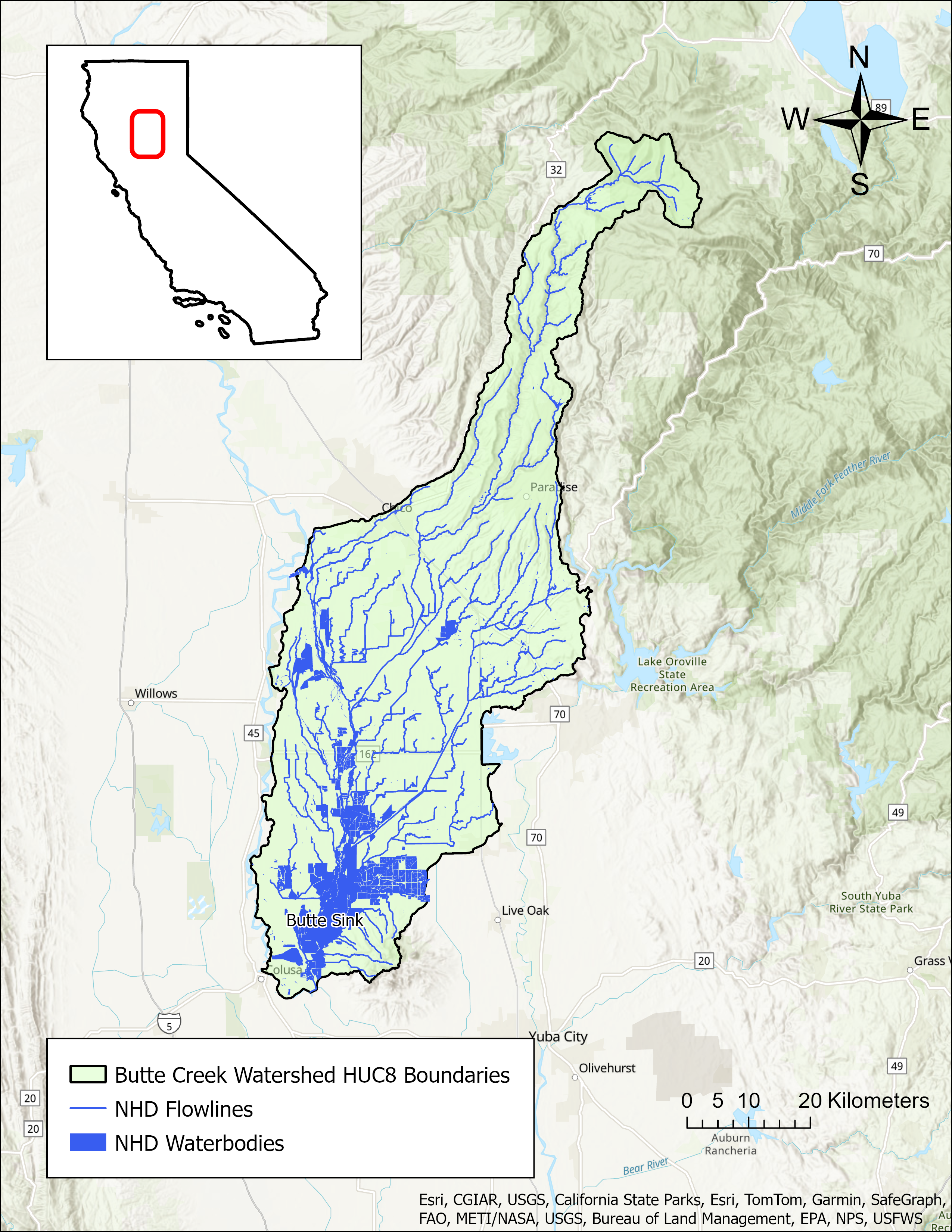
The Butte Creek Watershed is located primarily in Butte County but extends into parts of Tehama, Sutter, Glenn, and Colusa Counties. It is approximately 520,000 acres and ranges in elevation from just above sea level in the lower valley to over 7,000 feet at its headwaters in the western Sierra Nevada Mountains. The watershed has been significantly altered with imported water from the Feather River and numerous diversions for hydropower, municipal, and agricultural uses. The upper watershed, a largely forested area, also contains the PG&E DeSabla-Centerville hydroelectric power plant, which operates two reservoirs, three powerhouses, and a network of dams and canals. The lower watershed is heavily managed for both irrigation water supply and flood control and includes a collection of diversion dams that operate year-round for wildlife, irrigation, and agricultural diversions. Butte Creek is a major tributary to the Sacramento River and provides miles of valuable habitat as the largest run of central valley spring-run chinook salmon, a threatened species listed under both the state and federal Endangered Species Act (ESA). The watershed is also home to the Butte Creek Ecological Preserve, a 93-acre site whose stewardship was transferred to the Mechoopda Indian Tribe of Chico Rancheria in 2022 under AB-379.
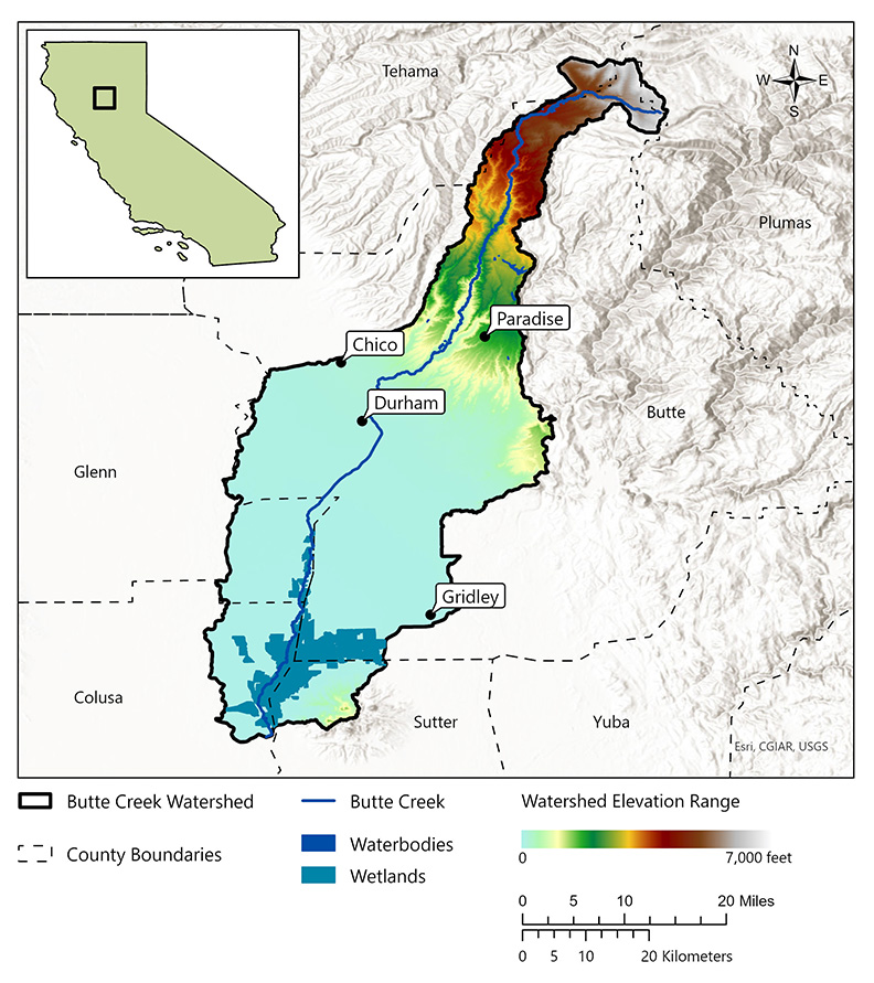
- Click on Map to Enlarge
Announcements
November 8, 2024 - Butte Creek Watershed Local Meeting on November 19
The Division will be holding a local meeting to provide an update on the status of work in the Butte Creek watershed. The meeting will be held at the Chico Branch Public Library Meeting Room in Chico on Novembewr 19, 2024, from 4-5pm. More information is available in the Outreach and Engagement section below. Please email questions to DWR-SDA@waterboards.ca.gov.
Model Development
Outreach and Engagement
- Butte Creek Watershed Fact Sheet
- Butte Creek Local Meeting – Flyer Available
Tuesday, November 19, 2024, from 4 to 5 pm
Chico Branch Library Meeting Room, 1108 Sherman Avenue, CA 95926
Modeling in the Butte Creek Watershed
The SDA Unit has continued to work on the models and tools developed for the Russian River Watershed during the State Water Board's 2021-2022 Regional Drought Response. These tools provided the necessary information for the Division of Water Rights (Division) to assess water availability and issue water right curtailments to ensure adequate, minimal water supplies for critical purposes under the emergency regulation.
To capture the water demand in the SDA Program Watersheds, water right demand estimates were incorporated based on information from annual reports of water diversion and use submitted to the Division. The SDA Unit continued to develop the Division’s demand dataset methodology and converted it into a series of R scripts and manual review spreadsheets that apply data quality correction flags. For example, the scripts identified and corrected unit conversion errors, duplicate reporting, and misplotted points of diversion. The SDA Unit then uses a water allocation tool adopted from the UC Davis Drought Water Rights Allocation Tool (DWRAT) to allocate available supply amongst water right holders based on their respective water right priority and water demands. This version of DWRAT allocates water at the subbasin level and accounts for imported flows.
The SDA Unit’s demand methodology, along with the supply scripts and the watershed specific versions of DWRAT, will be made available on the California Water Board Data Center GitHub page as separate repositories.
Additional Resources
Supply and Demand Assessment Program Links
Supply and Demand Assessment Information
Project Watersheds:
Stay Informed
Email Subscription List
Subscribe to the SDA Information email topic to receive notifications and the latest updates.
Contact Us
If you have questions or please email them to: DWR-SDA@waterboards.ca.gov
